Area Overview for RH8 9WD
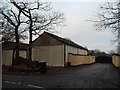
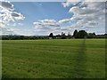
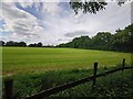
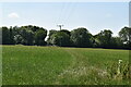
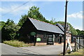
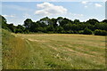
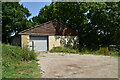
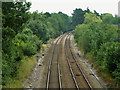
Photos of RH8 9WD


Area Information
Living in RH8 9WD offers a settled residential experience within a tightly knit cluster of homes. This specific postcode serves approximately 1,513 people, resulting in a population density of 230 people per square kilometre. Such a moderate density suggests a tranquil environment without the congestion of larger towns. The area functions as a small residential hub where neighbours often know one another. Daily life moves at a measured pace, characterised by proximity to convenience rather than high-rise density. You will find yourself in a setting that prioritises quiet living. The location slices through the wider outskirts where families and older residents coexist comfortably. There is a distinct lack of urban sprawl, which keeps noise and traffic levels manageable. This postcode stands out for its exclusivity and calm atmosphere compared to more crowded districts nearby. It appeals to those seeking a escape from city centre chaos while maintaining access to necessary services. The small size of the cluster fosters a strong sense of community among the households within its boundaries.
- Area Type
- Postcode
- Area Size
- Not available
- Population
- 1513
- Population Density
- 230 people/km²
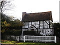
The property market in RH8 9WD is defined by a predominance of owner-occupied families rather than investors or short-term tenants. This pattern is evident in the 58% home ownership rate, which signals a neighbourhood where people have put down roots. Houses are the primary accommodation type, suggesting a supply of detached or semi-detached properties rather than high-density flats. This housing stock appeals to those looking for space, gardens, and a traditional street layout typical of the TH8 postcode sector. Because the area is a specific residential cluster, inventory may move slower than in larger towns due to the limited number of houses available. The market behaves differently from transaction-heavy areas, often relying on private sales networks as much as estate agents. Buyers targeting this location should expect a steady but somewhat slower pace of exchange. The focus on houses means the pricing reflects larger footprints and land value rather than flat premiums. This makes RH8 9WD a niche market for those who specifically require household space and privacy.
House Prices in RH8 9WD
No properties found in this postcode.
Energy Efficiency in RH8 9WD
Your daily life in RH8 9WD benefits from immediate access to essential services without needing to travel far into town. Retail needs are met locally, with venues such as Morrisons Oxted, The Southern Co-operative Co, and Cook Oxted located within a practical reach. These shops cover groceries, household essentials, and daily shopping requirements, meaning you can complete errands efficiently. For those who prefer to walk rather than drive, these amenities are ideally placed. Transport links are equally convenient, with five railway stations including Hurst Green, Oxted, and Godstone within easy reach. Specific trains from Hurst Green Railway Station, Oxted Railway Station, and Godstone Railway Station connect you to broader networks. This proximity means you have flexibility in your travel options. Whether you are grabbing groceries from Cook Oxted or catching a train, the layout supports a low-stress routine. You do not need to bundle up and rush to reach basic conveniences.
Amenities
Schools
Education remains a key consideration for families considering RH8 9WD. The nearest options include Merle Common First School, which serves as the primary education establishment for younger children in the vicinity. For early years learning, this primary school provides the foundation for local pupils. As children grow, they may transition to other provisions, though the data highlights limited secondary options immediately on the doorstep for this specific cluster. Moor House School & College is situated nearby, categorised as a special school, which caters to students with specific educational needs. You will find that the local educational mix leans towards specialist and primary provisions rather than a full range of comprehensive secondary institutions within immediate walking distance. This implies that students may need to travel further for secondary education depending on their age and school of choice. The presence of Merle Common First School indicates a commitment to local early years education regardless of the throughput for older age groups.
| Rank | School | Type | Entry gender | Ages |
|---|
Explore more schools in this area
Go to Schools tabDemographics
The community within RH8 9WD reflects a mature demographic profile centred on stability. The median age across this area is 47 years, positioning it firmly within the life stage of established families and retirees. The vast majority of the population falls into the 30 to 64 year bracket, indicating a workforce that is likely locally engaged or working remotely. Home ownership is significant here, with 58% of residents owning their homes outright or with a significant equity stake. This level of ownership contrasts sharply with typical high-rent rental concentrations in other parts of London and the South East. Houses dominate the accommodation landscape, catering to larger families and those seeking traditional British living arrangements. The predominant ethnic group is White, which aligns with the historical development of estates in this part of the county. You will encounter a community defined by long-term residency rather than transient renting. This demographic stability often translates into lower turnover rates and a more consistent local culture.
Household Size
Accommodation Type
Tenure
Ethnic Group
Religion
Household Composition
Age
Household Deprivation
NS-SEC
Explore more demographic insights in this area
Go to Demographics tabPlanning
Planning Constraints
- Flood RiskPremium
- Ramsar Wetland SitesPremium
- Area of Outstanding Natural BeautyPremium
- Protected Nature ReservePremium
- Protected WoodlandPremium