Area Overview for RH8 9ED
Photos of RH8 9ED
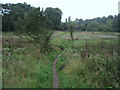
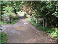
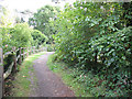
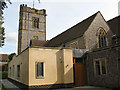
55 photos from this area
Area Information
Key information about the RH8 9ED including its size, population, and administrative classification.
- Area Type
- Postcode
- Area Size
- 4.2 hectares
- Population
- 1368
- Population Density
- 1665 people/km²
House Prices in RH8 9ED
15
Properties
£955,357
Average Sold Price
£430,000
Lowest Price
£1,455,000
Highest Price
Showing 15 properties
| Address | Type | Beds | Baths | Last Sale Price | Last Sale Date | |
|---|---|---|---|---|---|---|
| 1, Red Cottages, Woodhurst Lane, Oxted, RH8 9ED | Semi-detached | 4 | 2 | £940,000 | Jun 2024 | |
| Round House Cottage, Woodhurst Lane, Oxted, RH8 9ED | Detached | 5 | 2 | £1,250,000 | Jan 2023 | |
| Greenacres, Woodhurst Lane, Oxted, RH8 9ED | house | 4 | 2 | £1,320,000 | Apr 2022 | |
| Ankerdine, Woodhurst Lane, Oxted, RH8 9ED | Detached | 3 | 2 | £770,000 | Aug 2013 | |
| 2, Red Cottages, Woodhurst Lane, Oxted, RH8 9ED | house | 3 | - | £430,000 | Nov 2012 | |
| Stone Hall, Woodhurst Lane, Oxted, RH8 9ED | Detached | 4 | - | £1,455,000 | Sep 2012 | |
| Fran Den, Woodhurst Lane, Oxted, RH8 9ED | Detached | 4 | - | £522,500 | Aug 2010 | |
| Annexe, Stonehamme, Woodhurst Lane, Oxted, RH8 9ED | Flat | - | - | - | - | |
| Former Flat, Stonehamme, Woodhurst Lane, Oxted, RH8 9ED | Flat | - | - | - | - | |
| Hinxton House, Woodhurst Lane, Oxted, RH8 9ED | Detached | - | - | - | - |
Page 1 of 2
Energy Efficiency in RH8 9ED
Amenities
Schools
| Rank | School | Type | Entry gender | Ages |
|---|
Explore more schools in this area
Go to Schools tabDemographics
Household Size
Family (3-5 people)
most common
Accommodation Type
Houses
most common
Tenure
91
majority
Ethnic Group
White
most common
Religion
N/A
most common
Household Composition
N/A
most common
Age
47
median
Adults (30-64 years)
most common
Household Deprivation
N/A
with no deprivation
NS-SEC
58
in Lower managerial occupations
Explore more demographic insights in this area
Go to Demographics tabPlanning
Planning Constraints
- Flood RiskPremium
- Ramsar Wetland SitesPremium
- Area of Outstanding Natural BeautyPremium
- Protected Nature ReservePremium
- Protected WoodlandPremium