Area Overview for RH8 0LW
Photos of RH8 0LW
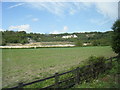


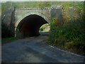

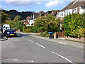
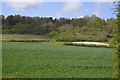
19 photos from this area
Area Information
Key information about the RH8 0LW including its size, population, and administrative classification.
- Area Type
- Postcode
- Area Size
- 2.1 hectares
- Population
- 1498
- Population Density
- 347 people/km²
House Prices in RH8 0LW
32
Properties
£424,073
Average Sold Price
£59,950
Lowest Price
£822,200
Highest Price
Showing 32 properties
| Address | Type | Beds | Baths | Last Sale Price | Last Sale Date | |
|---|---|---|---|---|---|---|
| 64 Gordons Way, Oxted, RH8 0LW | Maisonette | 2 | 1 | £295,000 | Aug 2025 | |
| 14 Gordons Way, Oxted, RH8 0LW | Semi-detached | 3 | 1 | £660,000 | Apr 2024 | |
| 40 Gordons Way, Oxted, RH8 0LW | Semi-detached | 3 | 1 | £625,000 | Oct 2023 | |
| 58 Gordons Way, Oxted, RH8 0LW | house | 3 | 1 | £620,000 | Aug 2023 | |
| 32 Gordons Way, Oxted, RH8 0LW | Semi-detached | 4 | 2 | £822,200 | Jan 2023 | |
| 34 Gordons Way, Oxted, RH8 0LW | Detached | 4 | 3 | £589,000 | Aug 2018 | |
| 36 Gordons Way, Oxted, RH8 0LW | house | 4 | 2 | £510,000 | Nov 2017 | |
| 42 Gordons Way, Oxted, RH8 0LW | Semi-detached | 4 | 1 | £540,000 | Dec 2015 | |
| 66 Gordons Way, Oxted, RH8 0LW | Flat | - | - | £290,000 | Sep 2015 | |
| 2 Gordons Way, Oxted, RH8 0LW | Detached | 2 | 4 | £715,000 | Aug 2015 |
Page 1 of 4
Energy Efficiency in RH8 0LW
Amenities
Schools
| Rank | School | Type | Entry gender | Ages |
|---|
Explore more schools in this area
Go to Schools tabDemographics
Household Size
Family (3-5 people)
most common
Accommodation Type
Houses
most common
Tenure
79
majority
Ethnic Group
White
most common
Religion
N/A
most common
Household Composition
N/A
most common
Age
47
median
Adults (30-64 years)
most common
Household Deprivation
N/A
with no deprivation
NS-SEC
46
in Lower managerial occupations
Explore more demographic insights in this area
Go to Demographics tabPlanning
Planning Constraints
- Flood RiskPremium
- Ramsar Wetland SitesPremium
- Area of Outstanding Natural BeautyPremium
- Protected Nature ReservePremium
- Protected WoodlandPremium