Area Overview for RH7 6RF
Photos of RH7 6RF


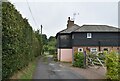


36 photos from this area
Area Information
Key information about the RH7 6RF including its size, population, and administrative classification.
- Area Type
- Postcode
- Area Size
- 2.8 hectares
- Population
- 1983
- Population Density
- 171 people/km²
House Prices in RH7 6RF
61
Properties
£260,034
Average Sold Price
£65,000
Lowest Price
£400,000
Highest Price
Showing 61 properties
| Address | Type | Beds | Baths | Last Sale Price | Last Sale Date | |
|---|---|---|---|---|---|---|
| 59 New Farthingdale, Dormansland, RH7 6RF | Detached | 2 | 1 | £400,000 | Mar 2025 | |
| 93 New Farthingdale, Dormansland, RH7 6RF | Semi-detached | 3 | 1 | £327,000 | May 2024 | |
| 95 New Farthingdale, Dormansland, RH7 6RF | Semi-detached | 3 | 1 | £330,000 | Jul 2023 | |
| 63 New Farthingdale, Dormansland, RH7 6RF | Semi-detached | 3 | 1 | £387,000 | Mar 2023 | |
| 79 New Farthingdale, Dormansland, RH7 6RF | Semi-detached | 3 | 2 | £380,000 | Jun 2021 | |
| 105 New Farthingdale, Dormansland, RH7 6RF | Terraced | 2 | 1 | £320,000 | Feb 2021 | |
| 9 New Farthingdale, Dormansland, RH7 6RF | Maisonette | 2 | 1 | £260,000 | Jun 2020 | |
| 29 New Farthingdale, Dormansland, RH7 6RF | Semi-detached | 4 | 1 | £395,000 | Jul 2018 | |
| 111 New Farthingdale, Dormansland, RH7 6RF | Terraced | 2 | 1 | £287,500 | Mar 2018 | |
| 55 New Farthingdale, Dormansland, RH7 6RF | Terraced | 2 | 1 | £306,000 | Feb 2018 |
Page 1 of 7
Energy Efficiency in RH7 6RF
Amenities
Schools
| Rank | School | Type | Entry gender | Ages |
|---|
Explore more schools in this area
Go to Schools tabDemographics
Household Size
Family (3-5 people)
most common
Accommodation Type
Houses
most common
Tenure
76
majority
Ethnic Group
White
most common
Religion
N/A
most common
Household Composition
N/A
most common
Age
47
median
Adults (30-64 years)
most common
Household Deprivation
N/A
with no deprivation
NS-SEC
40
in Lower managerial occupations
Explore more demographic insights in this area
Go to Demographics tabPlanning
Planning Constraints
- Flood RiskPremium
- Ramsar Wetland SitesPremium
- Area of Outstanding Natural BeautyPremium
- Protected Nature ReservePremium
- Protected WoodlandPremium