Area Overview for RH7 6EF
Photos of RH7 6EF


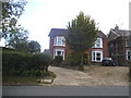
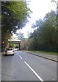
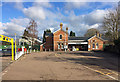
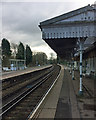
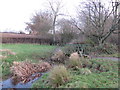
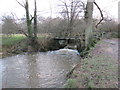
54 photos from this area
Area Information
Key information about the RH7 6EF including its size, population, and administrative classification.
- Area Type
- Postcode
- Area Size
- 10.8 hectares
- Population
- 1484
- Population Density
- 1686 people/km²
House Prices in RH7 6EF
15
Properties
£988,333
Average Sold Price
£560,000
Lowest Price
£1,450,000
Highest Price
Showing 15 properties
| Address | Type | Beds | Baths | Last Sale Price | Last Sale Date | |
|---|---|---|---|---|---|---|
| Brook House, Station Road, Lingfield, RH7 6EF | Detached | 4 | 5 | £1,450,000 | Dec 2021 | |
| Court End, Station Road, Lingfield, RH7 6EF | Detached | 3 | 1 | £955,000 | Jul 2018 | |
| New Place Stables, Station Road, Lingfield, RH7 6EF | Detached | - | - | £560,000 | May 2005 | |
| Ashcroft, Station Road, Lingfield, RH7 6EF | Detached | 5 | 3 | - | - | |
| The Longhouse, New Place Farm, Station Road, Lingfield, RH7 6EF | Bungalow | 3 | 1 | - | - | |
| West Side, New Place Farm, Station Road, Lingfield, RH7 6EF | Character Property | 4 | 2 | - | - | |
| Oast House, New Place Farm, Station Road, Lingfield, RH7 6EF | Semi-detached | 4 | 3 | - | - | |
| Mobile Home, Ashcroft, Station Road, Lingfield, RH7 6EF | Mobile Home | - | - | - | - | |
| East Wing, New Place Farm, Station Road, Lingfield, RH7 6EF | Terraced | - | - | - | - | |
| Lingfield Railway Station, Station Road, Lingfield, RH7 6EF | commercial | - | - | - | - |
Page 1 of 2
Energy Efficiency in RH7 6EF
Amenities
Schools
| Rank | School | Type | Entry gender | Ages |
|---|
Explore more schools in this area
Go to Schools tabDemographics
Household Size
Family (3-5 people)
most common
Accommodation Type
Houses
most common
Tenure
81
majority
Ethnic Group
White
most common
Religion
N/A
most common
Household Composition
N/A
most common
Age
47
median
Adults (30-64 years)
most common
Household Deprivation
N/A
with no deprivation
NS-SEC
42
in Lower managerial occupations
Explore more demographic insights in this area
Go to Demographics tabPlanning
Planning Constraints
- Flood RiskPremium
- Ramsar Wetland SitesPremium
- Area of Outstanding Natural BeautyPremium
- Protected Nature ReservePremium
- Protected WoodlandPremium