Area Overview for RH6 9PJ
Photos of RH6 9PJ

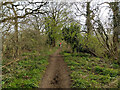
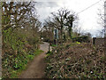
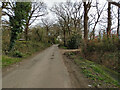
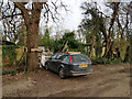
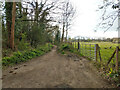
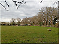
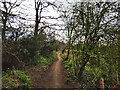
49 photos from this area
Area Information
Key information about the RH6 9PJ including its size, population, and administrative classification.
- Area Type
- Postcode
- Area Size
- 42.5 hectares
- Population
- 1669
- Population Density
- 595 people/km²
House Prices in RH6 9PJ
23
Properties
£484,083
Average Sold Price
£105,000
Lowest Price
£825,000
Highest Price
Showing 23 properties
| Address | Type | Beds | Baths | Last Sale Price | Last Sale Date | |
|---|---|---|---|---|---|---|
| Holmesdale Farm, Haroldslea Drive, Horley, RH6 9PJ | Bungalow | - | - | £352,500 | Jul 2018 | |
| Brook House, Haroldslea Drive, Horley, RH6 9PJ | Detached | 4 | 4 | £825,000 | Sep 2017 | |
| Mistad Manor, Haroldslea, Horley, RH6 9PJ | Bungalow | 4 | - | £540,000 | Oct 2015 | |
| Rivendell, Haroldslea, Horley, RH6 9PJ | Retail | 6 | 3 | £487,000 | Oct 2007 | |
| Little Snoring Farm, Haroldslea, Horley, RH6 9PJ | Detached | - | - | £595,000 | Oct 2004 | |
| Fairview, Haroldslea, Horley, RH6 9PJ | Detached | - | - | £105,000 | Feb 1997 | |
| The Oaks, Haroldslea, Horley, RH6 9PJ | Bungalow | 4 | 2 | - | - | |
| Woodlands, Haroldslea, Horley, RH6 9PJ | Detached | 4 | - | - | - | |
| Mobile Home At, Acre Stables, Haroldslea, Horley, RH6 9PJ | Mobile Home | - | - | - | - | |
| Animal Protection Trust, Coldlands Farm, Haroldslea, Horley, RH6 9PJ | commercial | - | - | - | - |
Page 1 of 3
Energy Efficiency in RH6 9PJ
Amenities
Schools
| Rank | School | Type | Entry gender | Ages |
|---|
Explore more schools in this area
Go to Schools tabDemographics
Household Size
Family (3-5 people)
most common
Accommodation Type
Houses
most common
Tenure
93
majority
Ethnic Group
White
most common
Religion
N/A
most common
Household Composition
N/A
most common
Age
47
median
Adults (30-64 years)
most common
Household Deprivation
N/A
with no deprivation
NS-SEC
44
in Lower managerial occupations
Explore more demographic insights in this area
Go to Demographics tabPlanning
Planning Constraints
- Flood RiskPremium
- Ramsar Wetland SitesPremium
- Area of Outstanding Natural BeautyPremium
- Protected Nature ReservePremium
- Protected WoodlandPremium