Area Overview for RH6 9BA
Photos of RH6 9BA
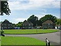
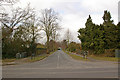
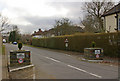
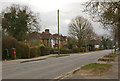
83 photos from this area
Area Information
Key information about the RH6 9BA including its size, population, and administrative classification.
- Area Type
- Postcode
- Area Size
- 10.1 hectares
- Population
- 1669
- Population Density
- 595 people/km²
House Prices in RH6 9BA
32
Properties
£455,003
Average Sold Price
£73,500
Lowest Price
£825,000
Highest Price
Showing 32 properties
| Address | Type | Beds | Baths | Last Sale Price | Last Sale Date | |
|---|---|---|---|---|---|---|
| 5 Silverlea Gardens, Horley, RH6 9BA | Detached | 4 | 2 | £825,000 | Nov 2025 | |
| 57 Silverlea Gardens, Horley, RH6 9BA | Detached | 4 | 3 | £665,000 | Dec 2024 | |
| 9 Silverlea Gardens, Horley, RH6 9BA | Detached | 4 | 2 | £738,000 | Nov 2022 | |
| 27 Silverlea Gardens, Horley, RH6 9BA | Detached | 4 | 2 | £730,000 | Jan 2021 | |
| 11A Silverlea Gardens, Horley, RH6 9BA | house | - | - | £515,000 | Feb 2018 | |
| 17 Silverlea Gardens, Horley, RH6 9BA | Detached | 5 | - | £650,000 | Nov 2015 | |
| 49 Silverlea Gardens, Horley, RH6 9BA | Detached | 3 | 1 | £375,500 | Oct 2015 | |
| 21 Silverlea Gardens, Horley, RH6 9BA | house | 3 | - | £400,000 | Feb 2015 | |
| 25 Silverlea Gardens, Horley, RH6 9BA | Detached | 4 | - | £548,100 | Dec 2014 | |
| 51 Silverlea Gardens, Horley, RH6 9BA | Semi-detached | 5 | - | £440,000 | Jun 2014 |
Page 1 of 4
Energy Efficiency in RH6 9BA
Amenities
Schools
| Rank | School | Type | Entry gender | Ages |
|---|
Explore more schools in this area
Go to Schools tabDemographics
Household Size
Family (3-5 people)
most common
Accommodation Type
Houses
most common
Tenure
93
majority
Ethnic Group
White
most common
Religion
N/A
most common
Household Composition
N/A
most common
Age
47
median
Adults (30-64 years)
most common
Household Deprivation
N/A
with no deprivation
NS-SEC
44
in Lower managerial occupations
Explore more demographic insights in this area
Go to Demographics tabPlanning
Planning Constraints
- Flood RiskPremium
- Ramsar Wetland SitesPremium
- Area of Outstanding Natural BeautyPremium
- Protected Nature ReservePremium
- Protected WoodlandPremium