Area Overview for RH6 8SJ
Photos of RH6 8SJ
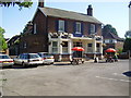

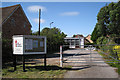
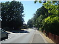
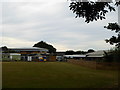
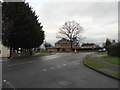
74 photos from this area
Area Information
Key information about the RH6 8SJ including its size, population, and administrative classification.
- Area Type
- Postcode
- Area Size
- 2.2 hectares
- Population
- 1924
- Population Density
- 3736 people/km²
House Prices in RH6 8SJ
14
Properties
£238,355
Average Sold Price
£107,000
Lowest Price
£430,000
Highest Price
Showing 14 properties
| Address | Type | Beds | Baths | Last Sale Price | Last Sale Date | |
|---|---|---|---|---|---|---|
| 6 Drake Road, Horley, RH6 8SJ | Semi-detached | 3 | 1 | £430,000 | May 2022 | |
| 11 Drake Road, Horley, RH6 8SJ | Semi-detached | 2 | - | £280,000 | Nov 2017 | |
| 7 Drake Road, Horley, RH6 8SJ | Detached | 3 | - | £370,000 | Jan 2017 | |
| 19 Drake Road, Horley, RH6 8SJ | house | 2 | - | £217,500 | Nov 2011 | |
| 17 Drake Road, Horley, RH6 8SJ | Semi-detached | - | - | £204,950 | Jul 2007 | |
| 9 Drake Road, Horley, RH6 8SJ | Detached | - | - | £274,950 | Jul 2007 | |
| 2 Drake Road, Horley, RH6 8SJ | Detached | 3 | 1 | £235,000 | Jan 2007 | |
| 3 Drake Road, Horley, RH6 8SJ | Semi-detached | - | - | £205,000 | Oct 2006 | |
| 1 Drake Road, Horley, RH6 8SJ | Land | - | - | £183,500 | Nov 2004 | |
| 8 Drake Road, Horley, RH6 8SJ | Detached | - | - | £114,000 | Nov 1999 |
Page 1 of 2
Energy Efficiency in RH6 8SJ
Amenities
Schools
| Rank | School | Type | Entry gender | Ages |
|---|
Explore more schools in this area
Go to Schools tabDemographics
Household Size
Family (3-5 people)
most common
Accommodation Type
Houses
most common
Tenure
70
majority
Ethnic Group
White
most common
Religion
N/A
most common
Household Composition
N/A
most common
Age
47
median
Adults (30-64 years)
most common
Household Deprivation
N/A
with no deprivation
NS-SEC
34
in Lower managerial occupations
Explore more demographic insights in this area
Go to Demographics tabPlanning
Planning Constraints
- Flood RiskPremium
- Ramsar Wetland SitesPremium
- Area of Outstanding Natural BeautyPremium
- Protected Nature ReservePremium
- Protected WoodlandPremium