Area Overview for RH6 8ND
Photos of RH6 8ND

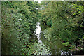

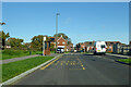
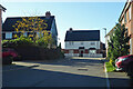
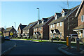
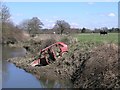

25 photos from this area
Area Information
Key information about the RH6 8ND including its size, population, and administrative classification.
- Area Type
- Postcode
- Area Size
- 8738 m²
- Population
- 1995
- Population Density
- 2654 people/km²
House Prices in RH6 8ND
32
Properties
£452,121
Average Sold Price
£345,000
Lowest Price
£633,000
Highest Price
Showing 32 properties
| Address | Type | Beds | Baths | Last Sale Price | Last Sale Date | |
|---|---|---|---|---|---|---|
| 14 Moy Green Drive, Horley, RH6 8ND | Semi-detached | 3 | 2 | £395,000 | Mar 2021 | |
| 34 Moy Green Drive, Horley, RH6 8ND | house | - | - | £425,000 | Jan 2021 | |
| 32 Moy Green Drive, Horley, RH6 8ND | house | - | - | £440,000 | Jan 2021 | |
| 36 Moy Green Drive, Horley, RH6 8ND | house | - | - | £599,950 | Oct 2018 | |
| 10 Moy Green Drive, Horley, RH6 8ND | house | - | - | £495,000 | Mar 2018 | |
| 18 Moy Green Drive, Horley, RH6 8ND | house | - | - | £435,000 | Feb 2018 | |
| 12 Moy Green Drive, Horley, RH6 8ND | Semi-detached | - | - | £435,000 | Jan 2018 | |
| 22 Moy Green Drive, Horley, RH6 8ND | house | - | - | £345,000 | Oct 2017 | |
| 20 Moy Green Drive, Horley, RH6 8ND | house | - | - | £355,000 | Oct 2017 | |
| 26 Moy Green Drive, Horley, RH6 8ND | house | - | - | £352,500 | Oct 2017 |
Page 1 of 4
Energy Efficiency in RH6 8ND
Amenities
Schools
| Rank | School | Type | Entry gender | Ages |
|---|
Explore more schools in this area
Go to Schools tabDemographics
Household Size
Family (3-5 people)
most common
Accommodation Type
Houses
most common
Tenure
87
majority
Ethnic Group
White
most common
Religion
N/A
most common
Household Composition
N/A
most common
Age
47
median
Adults (30-64 years)
most common
Household Deprivation
N/A
with no deprivation
NS-SEC
54
in Lower managerial occupations
Explore more demographic insights in this area
Go to Demographics tabPlanning
Planning Constraints
- Flood RiskPremium
- Ramsar Wetland SitesPremium
- Area of Outstanding Natural BeautyPremium
- Protected Nature ReservePremium
- Protected WoodlandPremium