Area Overview for RH6 0BY
Photos of RH6 0BY
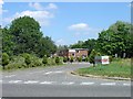
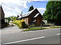
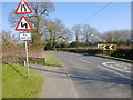
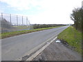
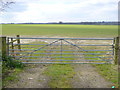
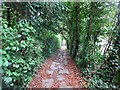

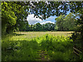
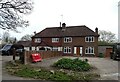
45 photos from this area
Area Information
Key information about the RH6 0BY including its size, population, and administrative classification.
- Area Type
- Postcode
- Area Size
- 13.3 hectares
- Population
- 2398
- Population Density
- 165 people/km²
House Prices in RH6 0BY
31
Properties
£398,946
Average Sold Price
£120,000
Lowest Price
£734,000
Highest Price
Showing 31 properties
| Address | Type | Beds | Baths | Last Sale Price | Last Sale Date | |
|---|---|---|---|---|---|---|
| The Mill, 41 The Street, Charlwood, RH6 0BY | Semi-detached | 2 | 1 | £550,000 | Nov 2023 | |
| Hidcote Cottage, 9 The Street, Charlwood, RH6 0BY | house | 3 | 2 | £734,000 | Mar 2023 | |
| Kilwa, 19 The Street, Charlwood, RH6 0BY | Detached | 3 | 2 | £515,000 | Oct 2022 | |
| The Chalet, 18 The Street, Charlwood, RH6 0BY | Bungalow | - | - | £455,000 | Jun 2021 | |
| Willow Cottage, 11 The Street, Charlwood, RH6 0BY | Semi-detached | 2 | 1 | £390,000 | Jul 2020 | |
| The Haven, 15 The Street, Charlwood, RH6 0BY | Semi-detached | 3 | 1 | £396,800 | Jul 2019 | |
| Spicers Villas, 5 The Street, Charlwood, RH6 0BY | Semi-detached | 3 | 2 | £345,000 | Oct 2016 | |
| Maybrook Cottage, 3 The Street, Charlwood, RH6 0BY | Semi-detached | 4 | 1 | £244,000 | May 2005 | |
| Millside, 31 The Street, Charlwood, RH6 0BY | house | 6 | 3 | £680,000 | Jan 2005 | |
| Charlwood Green, 35 The Street, Charlwood, RH6 0BY | Detached | - | - | £392,500 | Jul 2002 |
Page 1 of 4
Energy Efficiency in RH6 0BY
Amenities
Schools
| Rank | School | Type | Entry gender | Ages |
|---|
Explore more schools in this area
Go to Schools tabDemographics
Household Size
Family (3-5 people)
most common
Accommodation Type
Houses
most common
Tenure
78
majority
Ethnic Group
White
most common
Religion
N/A
most common
Household Composition
N/A
most common
Age
47
median
Adults (30-64 years)
most common
Household Deprivation
N/A
with no deprivation
NS-SEC
39
in Lower managerial occupations
Explore more demographic insights in this area
Go to Demographics tabPlanning
Planning Constraints
- Flood RiskPremium
- Ramsar Wetland SitesPremium
- Area of Outstanding Natural BeautyPremium
- Protected Nature ReservePremium
- Protected WoodlandPremium