Area Overview for RH6 0AS
Photos of RH6 0AS
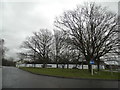
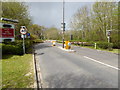
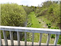
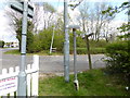
29 photos from this area
Area Information
Key information about the RH6 0AS including its size, population, and administrative classification.
- Area Type
- Postcode
- Area Size
- 1.4 hectares
- Population
- 2398
- Population Density
- 165 people/km²
House Prices in RH6 0AS
26
Properties
£310,436
Average Sold Price
£82,950
Lowest Price
£533,000
Highest Price
Showing 26 properties
| Address | Type | Beds | Baths | Last Sale Price | Last Sale Date | |
|---|---|---|---|---|---|---|
| 1, The Limes, Reigate Road, Hookwood, RH6 0AS | Terraced | 3 | 1 | £390,000 | Jun 2024 | |
| 1, Belmore Cottages, Reigate Road, Hookwood, RH6 0AS | Detached | 4 | 2 | £533,000 | Dec 2021 | |
| 6, Hilltop Cottages, Reigate Road, Hookwood, RH6 0AS | Semi-detached | 2 | 2 | £396,000 | Nov 2021 | |
| 3, The Limes, Reigate Road, Hookwood, RH6 0AS | Terraced | 3 | 1 | £325,000 | Jul 2019 | |
| 4, Chiltern Cottages, Reigate Road, Hookwood, RH6 0AS | Semi-detached | 3 | 2 | £365,000 | Jun 2018 | |
| 1, Lemburg Cottages, Reigate Road, Hookwood, RH6 0AS | Semi-detached | 3 | 1 | £335,000 | Jun 2015 | |
| 1, Hilltop Cottages, Reigate Road, Hookwood, Horley, RH6 0AS | Semi-detached | 4 | 1 | £380,000 | Jan 2015 | |
| 4, Hilltop Cottages, Reigate Road, Hookwood, RH6 0AS | Semi-detached | 3 | 2 | £315,000 | Oct 2014 | |
| 1, Chiltern Cottages, Reigate Road, Hookwood, RH6 0AS | Terraced | 3 | - | £312,000 | Oct 2014 | |
| Westcroft, Reigate Road, Hookwood, RH6 0AS | Detached | 4 | - | £420,000 | Jun 2014 |
Page 1 of 3
Energy Efficiency in RH6 0AS
Amenities
Schools
| Rank | School | Type | Entry gender | Ages |
|---|
Explore more schools in this area
Go to Schools tabDemographics
Household Size
Family (3-5 people)
most common
Accommodation Type
Houses
most common
Tenure
78
majority
Ethnic Group
White
most common
Religion
N/A
most common
Household Composition
N/A
most common
Age
47
median
Adults (30-64 years)
most common
Household Deprivation
N/A
with no deprivation
NS-SEC
39
in Lower managerial occupations
Explore more demographic insights in this area
Go to Demographics tabPlanning
Planning Constraints
- Flood RiskPremium
- Ramsar Wetland SitesPremium
- Area of Outstanding Natural BeautyPremium
- Protected Nature ReservePremium
- Protected WoodlandPremium