Area Overview for RH6 0AJ
Photos of RH6 0AJ
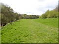
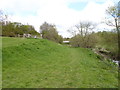
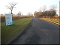
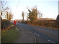
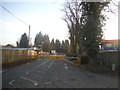
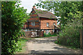
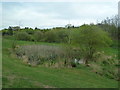

16 photos from this area
Area Information
Key information about the RH6 0AJ including its size, population, and administrative classification.
- Area Type
- Postcode
- Area Size
- 24.9 hectares
- Population
- 2398
- Population Density
- 165 people/km²
House Prices in RH6 0AJ
26
Properties
£428,625
Average Sold Price
£90,000
Lowest Price
£900,000
Highest Price
Showing 26 properties
| Address | Type | Beds | Baths | Last Sale Price | Last Sale Date | |
|---|---|---|---|---|---|---|
| Woodside, Charlwood Road, Charlwood, RH6 0AJ | house | - | - | £387,000 | Mar 2025 | |
| The Oaks, Charlwood Road, Charlwood, RH6 0AJ | Detached | 3 | 2 | £850,000 | Dec 2016 | |
| Taranaki, Charlwood Road, Charlwood, RH6 0AJ | Bungalow | 3 | - | £368,000 | Aug 2016 | |
| Routh, Charlwood Road, Charlwood, RH6 0AJ | Detached | 6 | 4 | £565,000 | Jan 2011 | |
| Suvla, Charlwood Road, Charlwood, RH6 0AJ | Detached | 5 | - | £900,000 | May 2007 | |
| Charlwood Park Cottage, Charlwood Road, Langley Green, Crawley, RH6 0AJ | Detached | - | - | £400,000 | Dec 2006 | |
| Long Spinney, Charlwood Road, Charlwood, RH6 0AJ | Detached | - | - | £400,000 | Sep 2001 | |
| Windlesham, Charlwood Road, Charlwood, RH6 0AJ | Detached | - | - | £175,000 | May 1999 | |
| Willowbrook, Charlwood Road, Charlwood, RH6 0AJ | Semi-detached | - | - | £151,250 | Apr 1999 | |
| Melton, Charlwood Road, Charlwood, RH6 0AJ | Semi-detached | - | - | £90,000 | Aug 1995 |
Page 1 of 3
Energy Efficiency in RH6 0AJ
Amenities
Schools
| Rank | School | Type | Entry gender | Ages |
|---|
Explore more schools in this area
Go to Schools tabDemographics
Household Size
Family (3-5 people)
most common
Accommodation Type
Houses
most common
Tenure
78
majority
Ethnic Group
White
most common
Religion
N/A
most common
Household Composition
N/A
most common
Age
47
median
Adults (30-64 years)
most common
Household Deprivation
N/A
with no deprivation
NS-SEC
39
in Lower managerial occupations
Explore more demographic insights in this area
Go to Demographics tabPlanning
Planning Constraints
- Flood RiskPremium
- Ramsar Wetland SitesPremium
- Area of Outstanding Natural BeautyPremium
- Protected Nature ReservePremium
- Protected WoodlandPremium