Area Overview for RH5 6PW
Photos of RH5 6PW
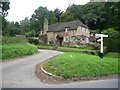
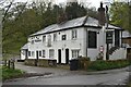
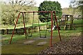
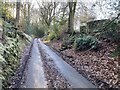
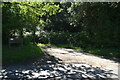
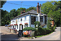
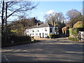
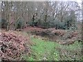
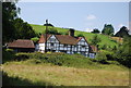
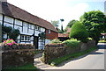
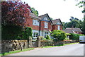
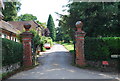
70 photos from this area
Area Information
Key information about the RH5 6PW including its size, population, and administrative classification.
- Area Type
- Postcode
- Area Size
- 11.5 hectares
- Population
- 1997
- Population Density
- 154 people/km²
House Prices in RH5 6PW
9
Properties
£873,500
Average Sold Price
£461,000
Lowest Price
£1,600,000
Highest Price
Showing 9 properties
| Address | Type | Beds | Baths | Last Sale Price | Last Sale Date | |
|---|---|---|---|---|---|---|
| Walnut Tree Cottage, Horsham Road, Abinger Hammer, RH5 6PW | Detached | - | - | £461,000 | Dec 2020 | |
| Spinney Cottage, Horsham Road, Abinger Hammer, RH5 6PW | house | - | - | £975,000 | Aug 2014 | |
| The Old Forge, Horsham Road, Abinger Hammer, RH5 6PW | Detached | 5 | 1 | £840,000 | May 2007 | |
| Sutton Barn, Horsham Road, Abinger Hammer, RH5 6PW | Semi-detached | - | - | £780,000 | Feb 2006 | |
| Sutton Place Cottage, Horsham Road, Abinger Hammer, RH5 6PW | Detached | - | - | £1,600,000 | Apr 2000 | |
| Mutton Farmhouse, Horsham Road, Abinger Hammer, RH5 6PW | Detached | 6 | 4 | £585,000 | Aug 1997 | |
| Sutton Cottage, Horsham Road, Abinger Hammer, RH5 6PW | Detached | - | - | - | - | |
| The Old Farm, Horsham Road, Abinger Hammer, RH5 6PW | house | - | - | - | - | |
| Tennis 57M From Sutton Place Cottage, Horsham Road 36M From B2126, Horsham Road, Abinger Hammer, RH5 6PW | Leisure | - | - | - | - |
Energy Efficiency in RH5 6PW
Amenities
Schools
| Rank | School | Type | Entry gender | Ages |
|---|
Explore more schools in this area
Go to Schools tabDemographics
Household Size
Two person
most common
Accommodation Type
Houses
most common
Tenure
88
majority
Ethnic Group
White
most common
Religion
N/A
most common
Household Composition
N/A
most common
Age
47
median
Adults (30-64 years)
most common
Household Deprivation
N/A
with no deprivation
NS-SEC
53
in Lower managerial occupations
Explore more demographic insights in this area
Go to Demographics tabPlanning
Planning Constraints
- Flood RiskPremium
- Ramsar Wetland SitesPremium
- Area of Outstanding Natural BeautyPremium
- Protected Nature ReservePremium
- Protected WoodlandPremium