Area Overview for RH5 6AY
Photos of RH5 6AY
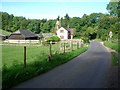
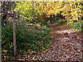
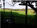
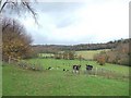
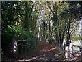

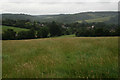
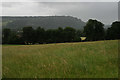
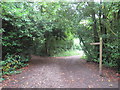
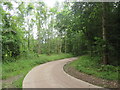
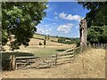

61 photos from this area
Area Information
Key information about the RH5 6AY including its size, population, and administrative classification.
- Area Type
- Postcode
- Area Size
- 54.5 hectares
- Population
- 1891
- Population Density
- 169 people/km²
House Prices in RH5 6AY
10
Properties
£1,314,000
Average Sold Price
£315,000
Lowest Price
£2,710,000
Highest Price
Showing 10 properties
| Address | Type | Beds | Baths | Last Sale Price | Last Sale Date | |
|---|---|---|---|---|---|---|
| Chapel House, Chapel Lane, Westhumble, RH5 6AY | Detached | 7 | 3 | £2,710,000 | Aug 2024 | |
| The Twinings, Chapel Lane, Westhumble, RH5 6AY | Detached | 5 | 2 | £1,150,000 | Jun 2015 | |
| Chapel Barn, Chapel Lane, Westhumble, RH5 6AY | house | 5 | - | £1,480,000 | Sep 2010 | |
| Postern House, Chapel Lane, Westhumble, RH5 6AY | Detached | - | - | £915,000 | Apr 2003 | |
| Chapel Cottage, Chapel Lane, Westhumble, RH5 6AY | Detached | - | - | £315,000 | Jan 2000 | |
| Ashcombe, Chapel Lane, Westhumble, RH5 6AY | Detached | 7 | 3 | - | - | |
| Chapel Farm, Chapel Lane, Westhumble, RH5 6AY | Terraced | 5 | - | - | - | |
| Tennis 56M From Chapel House, Chapel Lane 36M From Chapel Lane, Chapel Lane, Westhumble, RH5 6AY | Leisure | - | - | - | - | |
| Chapel Hurst, Chapel Lane, Westhumble, RH5 6AY | Terraced | - | - | - | - | |
| Ashleigh Grange, Chapel Lane, Westhumble, RH5 6AY | Detached | - | - | - | - |
Energy Efficiency in RH5 6AY
Amenities
Schools
| Rank | School | Type | Entry gender | Ages |
|---|
Explore more schools in this area
Go to Schools tabDemographics
Household Size
Two person
most common
Accommodation Type
Houses
most common
Tenure
79
majority
Ethnic Group
White
most common
Religion
N/A
most common
Household Composition
N/A
most common
Age
47
median
Adults (30-64 years)
most common
Household Deprivation
N/A
with no deprivation
NS-SEC
53
in Lower managerial occupations
Explore more demographic insights in this area
Go to Demographics tabPlanning
Planning Constraints
- Flood RiskPremium
- Ramsar Wetland SitesPremium
- Area of Outstanding Natural BeautyPremium
- Protected Nature ReservePremium
- Protected WoodlandPremium