Area Overview for RH5 4BL
Photos of RH5 4BL
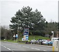
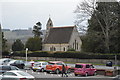
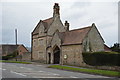
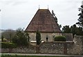
100 photos from this area
Area Information
Key information about the RH5 4BL including its size, population, and administrative classification.
- Area Type
- Postcode
- Area Size
- 20.5 hectares
- Population
- 1718
- Population Density
- 784 people/km²
House Prices in RH5 4BL
11
Properties
£1,404,763
Average Sold Price
£805,000
Lowest Price
£1,850,000
Highest Price
Showing 11 properties
| Address | Type | Beds | Baths | Last Sale Price | Last Sale Date | |
|---|---|---|---|---|---|---|
| Birch Hollow, Park Copse, Dorking, RH5 4BL | house | - | - | £1,500,000 | May 2021 | |
| The White House, Park Copse, Dorking, RH5 4BL | house | - | - | £1,700,000 | Aug 2019 | |
| Broad Beech, Park Copse, Dorking, RH5 4BL | Detached | 7 | 3 | £1,850,000 | Jun 2017 | |
| Silver Mist, Park Copse, Dorking, RH5 4BL | Detached | 7 | 4 | £1,165,000 | Jan 2015 | |
| Silverwood, Park Copse, Dorking, RH5 4BL | house | 5 | - | £1,560,000 | Sep 2010 | |
| Brockshaw, Park Copse, Dorking, RH5 4BL | Detached | - | - | £805,000 | Apr 2006 | |
| Courtlands, Park Copse, Dorking, RH5 4BL | Detached | - | - | £1,253,342 | Mar 2003 | |
| Tennis 30M From Courtlands, Park Copse 25M From Park Copse, Park Copse, Dorking, RH5 4BL | Leisure | - | - | - | - | |
| The End House, Park Copse, Dorking, RH5 4BL | Detached | - | - | - | - | |
| Burntwood House, Park Copse, Dorking, RH5 4BL | Detached | - | - | - | - |
Page 1 of 2
Energy Efficiency in RH5 4BL
Amenities
Schools
| Rank | School | Type | Entry gender | Ages |
|---|
Explore more schools in this area
Go to Schools tabDemographics
Household Size
One person
most common
Accommodation Type
Houses
most common
Tenure
72
majority
Ethnic Group
White
most common
Religion
N/A
most common
Household Composition
N/A
most common
Age
47
median
Adults (30-64 years)
most common
Household Deprivation
N/A
with no deprivation
NS-SEC
49
in Lower managerial occupations
Explore more demographic insights in this area
Go to Demographics tabPlanning
Planning Constraints
- Flood RiskPremium
- Ramsar Wetland SitesPremium
- Area of Outstanding Natural BeautyPremium
- Protected Nature ReservePremium
- Protected WoodlandPremium