Area Overview for RH4 3RR
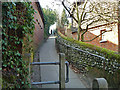
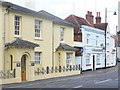
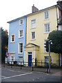
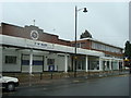
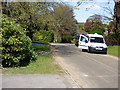
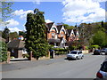
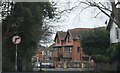
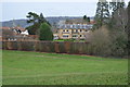
Photos of RH4 3RR


Area Information
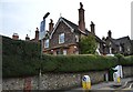
Living in RH4 3RR offers a quiet residential experience within the Greater London area. This specific postcode covers a small residential cluster serving a population of 1,833 people. The location appeals to those seeking a settled community rather than a bustling city centre. You will find yourself in an environment defined by stability and established neighbourhoods. The area functions as a self-contained residential zone where daily life revolves around local access rather than long commutes to distant hubs. Residents enjoy a straightforward existence without the noise or congestion of larger urban centres. The limited size of the cluster fosters a tight-knit atmosphere where neighbours know one another. Daily routines involve accessing nearby rail stations and local shops for most of your needs. You do not need to travel far for essential services or school runs. The area maintains a consistent character where houses dominate the skyline. It is a place for those who value privacy and a predictable routine above all else. The proximity to Dorking ensures you are close to larger amenities while retaining your own independence. You can walk or drive to local supermarkets and train lines with minimal effort. This postcode represents a practical choice for families or individuals prioritising a calm setting. The community in RH4 3RR is defined by a mature demographic profile with a median age of 47. The most common age range consists of adults between 30 and 64 years old. This indicates a stable population where established households form the core of the residents. You will encounter fewer single-person young households compared to other urban areas. Home ownership stands at 74%, which is notably high for a residential cluster of this size. Three quarters of the homes are owned outright or with a mortgage rather than rented. This statistic suggests a long-term commitment from the people living here and less transient turnover of occupants. Houses are the predominant accommodation type, meaning terraced or detached family homes make up the bulk of the stock. You will find multi-unit apartment blocks to be rare in this specific postcode. The predominant ethnic group is White, reflecting the traditional character of many homes in this section of the London suburbs. The area feels like a place where people stay and raise their families over decades. There is little evidence of rapid demographic shifts or diverse young professional influxes. The age distribution supports a quiet environment suitable for children and older residents alike. The property market in RH4 3RR reflects a landscape dominated by private ownership. With 74% home ownership, the area functions primarily as a market for existing homeowners rather than a hub for private landlords. You are unlikely to find rows of purpose-built rental estates or high-density blocks of flats. Houses are the standard accommodation type, offering space and grounds that appeal to buyers seeking permanence. This high retention rate means the housing stock carries history and established value within the cluster. If you are looking to purchase, you will engage with local owners well integrated into the community. The market here is distinct from areas where investment buy-to-let properties drive prices. You will encounter a mix of family-sized properties designed for longer-term living. The absence of significant rental blocks simplifies the landscape for those wishing to buy. Prices likely reflect the convenience of rail links and proximity to Dorking rather than intrinsically dramatic features. Sellers here cater to residents who value stability over speculation. The architectural style and tenure mix create a uniform market where homes sell based on condition and location. Buyers should prepare for a market driven by local demand rather than transient investors. Digital connectivity in RH4 3RR is robust enough to support heavy internet usage and remote work. Fixed broadband scores 95 out of 100, placing it in the excellent category. You can rely on high-speed internet for video calls, large file transfers, and streaming without interruption. This level of service ensures that working from home remains a viable and comfortable option for residents. Mobile coverage scores 76 out of 100, which falls into the good range. Signal strength will be sufficient for daily navigation, social media use, and emergency communication. You may find signal occasionally weaker in deep residential pockets or if standing behind large thick walls. However, the network remains reliable for standard connectivity needs. The area supports both stationary data transfer and mobile communication effectively. Commuters benefit from noise-free home environments while maintaining strong digital ties to the outside world. You do not need to worry about poor lines affecting your professional work life. The combination of fixed and mobile networks creates a dependable infrastructure for modern living. This allows you to stay connected to colleagues and family regardless of your position in the house. Daily life in RH4 3RR centres on practical access to key amenities within practical reach. You have five retail options nearby, including Budgens Oaks, Lidl Pippbrook, and Waitrose Dorking. These superstores provide you with weekly grocery shopping and household essentials without a long journey. For travel, you have access to five railway stations, specifically Dorking West, Dorking Deepdene, and Dorking Railway Station. You can choose the station that best fits your commute needs or travel preferences. Access to Dorking gives you a wider range of dining and leisure choices just a short ride away. The area functions well without requiring frequent trips to London or further afield. You can run errands or pick up fresh produce in the comfort of your immediate vicinity. The retail selection includes major national chains serving the local population. Public transport links ensure you are not isolated from the wider train network. Shopping trips become convenient afternoon activities rather than major logistical challenges. The presence of diverse retailers means you can find everything from fresh food to household goods. Safety and environmental conditions in RH4 3RR present a mixed picture for potential residents. The area passes all environmental safety checks with flying colours. There is no flood risk coverage, resulting in a score of 0 and a pass level. You do not need to worry about rising water or climate-related property damage. The site contains no Ramsar wetland sites, Areas of Outstanding Natural Beauty, protected nature reserves, or protected woodland. All planning constraint scores are 0, indicating a clear area without environmental restrictions. However, crime risk presents a notable concern with a warning level and a score of 60 out of 100. This medium crime risk suggests that incidents occur at rates around the average for the region. You should expect theft or anti-social behaviour to be a possibility that requires vigilance. Standard security precautions are advisable to protect your property and family. While the physical environment is free from natural hazards, the social safety net requires active engagement. Residents must remain alert and aware of their surroundings to mitigate risks. The contrast between perfect environmental scores and moderate crime statistics defines the current safety profile. Who is the typical resident of RH4 3RR?The area has a median age of 47, with the majority being adults aged 30 to 64. Three quarters of the population own their homes, indicating a stable, settled community rather than one of transient renters. What connectivity options are available for working from home?Fixed broadband scores 95/100 for excellent performance. Mobile coverage scores 76/100, which is considered good. These scores ensure you can work from home reliably and stay connected to mobile networks without major issues. Is the area safe from environmental risks?The postcode passes all safety checks. Flood risk is non-existent with a score of 0, and there are no protected environmental constraints like wetlands or woodlands. However, crime risk is medium with a score of 60/100, so standard security precautions are necessary. Which shops and train stations can I reach easily?Residents have access to Budgens Oaks, Lidl Pippbrook, and Waitrose Dorking for shopping. Nearby rail links include Dorking West, Dorking Deepdene, and Dorking Railway Station, offering five station options for your commute.
- Area Type
- Postcode
- Area Size
- Not available
- Population
- 1833
- Population Density
- 2595 people/km²
The property market in RH4 3RR reflects a landscape dominated by private ownership. With 74% home ownership, the area functions primarily as a market for existing homeowners rather than a hub for private landlords. You are unlikely to find rows of purpose-built rental estates or high-density blocks of flats. Houses are the standard accommodation type, offering space and grounds that appeal to buyers seeking permanence. This high retention rate means the housing stock carries history and established value within the cluster. If you are looking to purchase, you will engage with local owners well integrated into the community. The market here is distinct from areas where investment buy-to-let properties drive prices. You will encounter a mix of family-sized properties designed for longer-term living. The absence of significant rental blocks simplifies the landscape for those wishing to buy. Prices likely reflect the convenience of rail links and proximity to Dorking rather than intrinsically dramatic features. Sellers here cater to residents who value stability over speculation. The architectural style and tenure mix create a uniform market where homes sell based on condition and location. Buyers should prepare for a market driven by local demand rather than transient investors. Digital connectivity in RH4 3RR is robust enough to support heavy internet usage and remote work. Fixed broadband scores 95 out of 100, placing it in the excellent category. You can rely on high-speed internet for video calls, large file transfers, and streaming without interruption. This level of service ensures that working from home remains a viable and comfortable option for residents. Mobile coverage scores 76 out of 100, which falls into the good range. Signal strength will be sufficient for daily navigation, social media use, and emergency communication. You may find signal occasionally weaker in deep residential pockets or if standing behind large thick walls. However, the network remains reliable for standard connectivity needs. The area supports both stationary data transfer and mobile communication effectively. Commuters benefit from noise-free home environments while maintaining strong digital ties to the outside world. You do not need to worry about poor lines affecting your professional work life. The combination of fixed and mobile networks creates a dependable infrastructure for modern living. This allows you to stay connected to colleagues and family regardless of your position in the house. Daily life in RH4 3RR centres on practical access to key amenities within practical reach. You have five retail options nearby, including Budgens Oaks, Lidl Pippbrook, and Waitrose Dorking. These superstores provide you with weekly grocery shopping and household essentials without a long journey. For travel, you have access to five railway stations, specifically Dorking West, Dorking Deepdene, and Dorking Railway Station. You can choose the station that best fits your commute needs or travel preferences. Access to Dorking gives you a wider range of dining and leisure choices just a short ride away. The area functions well without requiring frequent trips to London or further afield. You can run errands or pick up fresh produce in the comfort of your immediate vicinity. The retail selection includes major national chains serving the local population. Public transport links ensure you are not isolated from the wider train network. Shopping trips become convenient afternoon activities rather than major logistical challenges. The presence of diverse retailers means you can find everything from fresh food to household goods. Safety and environmental conditions in RH4 3RR present a mixed picture for potential residents. The area passes all environmental safety checks with flying colours. There is no flood risk coverage, resulting in a score of 0 and a pass level. You do not need to worry about rising water or climate-related property damage. The site contains no Ramsar wetland sites, Areas of Outstanding Natural Beauty, protected nature reserves, or protected woodland. All planning constraint scores are 0, indicating a clear area without environmental restrictions. However, crime risk presents a notable concern with a warning level and a score of 60 out of 100. This medium crime risk suggests that incidents occur at rates around the average for the region. You should expect theft or anti-social behaviour to be a possibility that requires vigilance. Standard security precautions are advisable to protect your property and family. While the physical environment is free from natural hazards, the social safety net requires active engagement. Residents must remain alert and aware of their surroundings to mitigate risks. The contrast between perfect environmental scores and moderate crime statistics defines the current safety profile. Who is the typical resident of RH4 3RR?The area has a median age of 47, with the majority being adults aged 30 to 64. Three quarters of the population own their homes, indicating a stable, settled community rather than one of transient renters. What connectivity options are available for working from home?Fixed broadband scores 95/100 for excellent performance. Mobile coverage scores 76/100, which is considered good. These scores ensure you can work from home reliably and stay connected to mobile networks without major issues. Is the area safe from environmental risks?The postcode passes all safety checks. Flood risk is non-existent with a score of 0, and there are no protected environmental constraints like wetlands or woodlands. However, crime risk is medium with a score of 60/100, so standard security precautions are necessary. Which shops and train stations can I reach easily?Residents have access to Budgens Oaks, Lidl Pippbrook, and Waitrose Dorking for shopping. Nearby rail links include Dorking West, Dorking Deepdene, and Dorking Railway Station, offering five station options for your commute.
House Prices in RH4 3RR
No properties found in this postcode.
Energy Efficiency in RH4 3RR
Daily life in RH4 3RR centres on practical access to key amenities within practical reach. You have five retail options nearby, including Budgens Oaks, Lidl Pippbrook, and Waitrose Dorking. These superstores provide you with weekly grocery shopping and household essentials without a long journey. For travel, you have access to five railway stations, specifically Dorking West, Dorking Deepdene, and Dorking Railway Station. You can choose the station that best fits your commute needs or travel preferences. Access to Dorking gives you a wider range of dining and leisure choices just a short ride away. The area functions well without requiring frequent trips to London or further afield. You can run errands or pick up fresh produce in the comfort of your immediate vicinity. The retail selection includes major national chains serving the local population. Public transport links ensure you are not isolated from the wider train network. Shopping trips become convenient afternoon activities rather than major logistical challenges. The presence of diverse retailers means you can find everything from fresh food to household goods. Safety and environmental conditions in RH4 3RR present a mixed picture for potential residents. The area passes all environmental safety checks with flying colours. There is no flood risk coverage, resulting in a score of 0 and a pass level. You do not need to worry about rising water or climate-related property damage. The site contains no Ramsar wetland sites, Areas of Outstanding Natural Beauty, protected nature reserves, or protected woodland. All planning constraint scores are 0, indicating a clear area without environmental restrictions. However, crime risk presents a notable concern with a warning level and a score of 60 out of 100. This medium crime risk suggests that incidents occur at rates around the average for the region. You should expect theft or anti-social behaviour to be a possibility that requires vigilance. Standard security precautions are advisable to protect your property and family. While the physical environment is free from natural hazards, the social safety net requires active engagement. Residents must remain alert and aware of their surroundings to mitigate risks. The contrast between perfect environmental scores and moderate crime statistics defines the current safety profile. Who is the typical resident of RH4 3RR?The area has a median age of 47, with the majority being adults aged 30 to 64. Three quarters of the population own their homes, indicating a stable, settled community rather than one of transient renters. What connectivity options are available for working from home?Fixed broadband scores 95/100 for excellent performance. Mobile coverage scores 76/100, which is considered good. These scores ensure you can work from home reliably and stay connected to mobile networks without major issues. Is the area safe from environmental risks?The postcode passes all safety checks. Flood risk is non-existent with a score of 0, and there are no protected environmental constraints like wetlands or woodlands. However, crime risk is medium with a score of 60/100, so standard security precautions are necessary. Which shops and train stations can I reach easily?Residents have access to Budgens Oaks, Lidl Pippbrook, and Waitrose Dorking for shopping. Nearby rail links include Dorking West, Dorking Deepdene, and Dorking Railway Station, offering five station options for your commute.
Amenities
Schools
| Rank | School | Type | Entry gender | Ages |
|---|
Explore more schools in this area
Go to Schools tabDemographics
The community in RH4 3RR is defined by a mature demographic profile with a median age of 47. The most common age range consists of adults between 30 and 64 years old. This indicates a stable population where established households form the core of the residents. You will encounter fewer single-person young households compared to other urban areas. Home ownership stands at 74%, which is notably high for a residential cluster of this size. Three quarters of the homes are owned outright or with a mortgage rather than rented. This statistic suggests a long-term commitment from the people living here and less transient turnover of occupants. Houses are the predominant accommodation type, meaning terraced or detached family homes make up the bulk of the stock. You will find multi-unit apartment blocks to be rare in this specific postcode. The predominant ethnic group is White, reflecting the traditional character of many homes in this section of the London suburbs. The area feels like a place where people stay and raise their families over decades. There is little evidence of rapid demographic shifts or diverse young professional influxes. The age distribution supports a quiet environment suitable for children and older residents alike. The property market in RH4 3RR reflects a landscape dominated by private ownership. With 74% home ownership, the area functions primarily as a market for existing homeowners rather than a hub for private landlords. You are unlikely to find rows of purpose-built rental estates or high-density blocks of flats. Houses are the standard accommodation type, offering space and grounds that appeal to buyers seeking permanence. This high retention rate means the housing stock carries history and established value within the cluster. If you are looking to purchase, you will engage with local owners well integrated into the community. The market here is distinct from areas where investment buy-to-let properties drive prices. You will encounter a mix of family-sized properties designed for longer-term living. The absence of significant rental blocks simplifies the landscape for those wishing to buy. Prices likely reflect the convenience of rail links and proximity to Dorking rather than intrinsically dramatic features. Sellers here cater to residents who value stability over speculation. The architectural style and tenure mix create a uniform market where homes sell based on condition and location. Buyers should prepare for a market driven by local demand rather than transient investors. Digital connectivity in RH4 3RR is robust enough to support heavy internet usage and remote work. Fixed broadband scores 95 out of 100, placing it in the excellent category. You can rely on high-speed internet for video calls, large file transfers, and streaming without interruption. This level of service ensures that working from home remains a viable and comfortable option for residents. Mobile coverage scores 76 out of 100, which falls into the good range. Signal strength will be sufficient for daily navigation, social media use, and emergency communication. You may find signal occasionally weaker in deep residential pockets or if standing behind large thick walls. However, the network remains reliable for standard connectivity needs. The area supports both stationary data transfer and mobile communication effectively. Commuters benefit from noise-free home environments while maintaining strong digital ties to the outside world. You do not need to worry about poor lines affecting your professional work life. The combination of fixed and mobile networks creates a dependable infrastructure for modern living. This allows you to stay connected to colleagues and family regardless of your position in the house. Daily life in RH4 3RR centres on practical access to key amenities within practical reach. You have five retail options nearby, including Budgens Oaks, Lidl Pippbrook, and Waitrose Dorking. These superstores provide you with weekly grocery shopping and household essentials without a long journey. For travel, you have access to five railway stations, specifically Dorking West, Dorking Deepdene, and Dorking Railway Station. You can choose the station that best fits your commute needs or travel preferences. Access to Dorking gives you a wider range of dining and leisure choices just a short ride away. The area functions well without requiring frequent trips to London or further afield. You can run errands or pick up fresh produce in the comfort of your immediate vicinity. The retail selection includes major national chains serving the local population. Public transport links ensure you are not isolated from the wider train network. Shopping trips become convenient afternoon activities rather than major logistical challenges. The presence of diverse retailers means you can find everything from fresh food to household goods. Safety and environmental conditions in RH4 3RR present a mixed picture for potential residents. The area passes all environmental safety checks with flying colours. There is no flood risk coverage, resulting in a score of 0 and a pass level. You do not need to worry about rising water or climate-related property damage. The site contains no Ramsar wetland sites, Areas of Outstanding Natural Beauty, protected nature reserves, or protected woodland. All planning constraint scores are 0, indicating a clear area without environmental restrictions. However, crime risk presents a notable concern with a warning level and a score of 60 out of 100. This medium crime risk suggests that incidents occur at rates around the average for the region. You should expect theft or anti-social behaviour to be a possibility that requires vigilance. Standard security precautions are advisable to protect your property and family. While the physical environment is free from natural hazards, the social safety net requires active engagement. Residents must remain alert and aware of their surroundings to mitigate risks. The contrast between perfect environmental scores and moderate crime statistics defines the current safety profile. Who is the typical resident of RH4 3RR?The area has a median age of 47, with the majority being adults aged 30 to 64. Three quarters of the population own their homes, indicating a stable, settled community rather than one of transient renters. What connectivity options are available for working from home?Fixed broadband scores 95/100 for excellent performance. Mobile coverage scores 76/100, which is considered good. These scores ensure you can work from home reliably and stay connected to mobile networks without major issues. Is the area safe from environmental risks?The postcode passes all safety checks. Flood risk is non-existent with a score of 0, and there are no protected environmental constraints like wetlands or woodlands. However, crime risk is medium with a score of 60/100, so standard security precautions are necessary. Which shops and train stations can I reach easily?Residents have access to Budgens Oaks, Lidl Pippbrook, and Waitrose Dorking for shopping. Nearby rail links include Dorking West, Dorking Deepdene, and Dorking Railway Station, offering five station options for your commute.
Household Size
Accommodation Type
Tenure
Ethnic Group
Religion
Household Composition
Age
Household Deprivation
NS-SEC
Explore more demographic insights in this area
Go to Demographics tabPlanning
Planning Constraints
- Flood RiskPremium
- Ramsar Wetland SitesPremium
- Area of Outstanding Natural BeautyPremium
- Protected Nature ReservePremium
- Protected WoodlandPremium