Area Overview for RH4 3HL
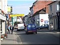
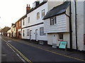
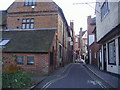
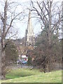
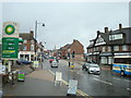
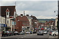
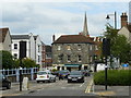
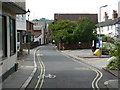
Photos of RH4 3HL


Area Information
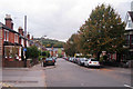
RH4 3HL represents a specific postcode covering a small residential cluster near Dorking in Surrey. This compact area forms part of a broader locality characterised by established housing and proximity to key transport links. Approximately 1,926 people call this immediate area home, creating a neighbourhood with a distinct sense of scale. Life here revolves around practical access to local services rather than walking distance amenities found in larger town centres. Residents benefit from being situated close to major railway stations, which facilitates easy commutes to London and the wider Thames Valley. The area maintains a residential focus without the heavy commercial footprint of a high street, making it suitable for those who prioritise quiet streets alongside good connectivity. Understanding the geography is essential for evaluating daily commutes or trips to local shops. The postcode serves as a gateway into a larger community that balances suburban comfort with efficient public transport links. Prospective buyers should consider the balance between the intimate nature of this cluster and the accessibility it offers to neighbouring villages and towns.
- Area Type
- Postcode
- Area Size
- Not available
- Population
- 1926
- Population Density
- 6524 people/km²
You will find that the housing stock in RH4 3HL consists primarily of houses due to the area's location and planning history. This structure signals a market geared towards family living and traditional suburban lifestyles rather than the compact living found in high-density towers. With 56% home ownership, the area feels firmly established, appealing to those looking to put down roots or purchase a family home on a solid foundation. The remaining residents live in rented accommodation, suggesting a smaller but steady stream of tenants. This high rate of ownership often correlates with greater investment in property maintenance and a stronger sense of community among neighbours. For buyers, this means the neighbourhood likely values longevity and stability over rapid turnover. Prices and demand will fluctuate based on the broader Dorking market, but the fundamental makeup of the area remains consistent. Purchasing a house here typically involves engaging with a market where sellers are often motivated by equity release or relocation rather than quick sales. Prospective buyers should prepare for a negotiation process that respects the significant capital many owners have accumulated in this specific postcode.
House Prices in RH4 3HL
No properties found in this postcode.
Energy Efficiency in RH4 3HL
Life in RH4 3HL centres on convenient access to three key areas: local shops, retail parks, and railway stations. You have five retail outlets within practical reach, including Waitrose Dorking, Sainsburys Dorking, and the Lidl Pippbrook store. These supermarkets provide everything from fresh groceries to weekly essentials, meaning you rarely need to drive far for basic needs. For rail connectivity, five stations serve the area, with Dorking West Railway Station, Dorking Deepdene Railway Station, and Dorking Railway Station being the notable stops. These stations offer frequent services to London Victoria and other major hubs, allowing you to commute without the stress of traffic. The availability of both premium and budget supermarkets gives you flexibility in how you shop, whether you prefer the slower pace of Waitrose or the value focus of Lidl. Having multiple railway options means you can choose the station best suited to your route or schedule, avoiding crowds at peak times if you wish. This mix of retail and transport infrastructure creates a self-sufficient lifestyle where daily necessities are always on hand.
Amenities
Schools
Families considering RH4 3HL have access to two specific educational institutions listed in the local vicinity. Dorking Nursery School serves the youngest children, providing care and early education in a community setting. For primary education, St Joseph's Catholic Primary School offers schooling with an Ofsted rating of good. This positive rating indicates a standard of education that meets national expectations and provides reassurance for parents considering these options for their children. The availability of a nursery alongside a primary school suggests a supportive environment for families with young children transitioning through early years education. While secondary school options are not detailed in the immediate dataset, the presence of these foundational schools indicates a commitment to early childhood development within the local framework. The mix of a maintained Catholic primary and a local nursery offers specific pathways for religious education or home-schooling families who might prefer a known provider. Enrolling nearby means reducing travel time for drop-offs and pick-ups, a practical benefit for busy households. The good rating of the primary school is a tangible asset that families can verify before making a decision on where to settle.
| Rank | School | Type | Entry gender | Ages |
|---|
Explore more schools in this area
Go to Schools tabDemographics
The community within RH4 3HL reflects the profile of a mature, establishment-heavy residential zone. The median age stands at 47 years, indicating that the population consists principally of adults between 30 and 64 years old. Nearly two-thirds of residents fall into this productive age bracket, suggesting a neighbourhood dominated by established households rather than young singles or empty nesters. Home ownership is a defining feature of the area, with 56% of residents owning their property outright or with a mortgage. This figure confirms that the market is heavily skewed towards owner-occupiers who have likely built equity over many years. The predominant ethnic group is White, which aligns with the traditional character of many Surrey settlements. Accommodation types are almost exclusively houses, meaning you will find very few flats or modern apartments in this specific cluster. These facts combine to create a stable environment where long-term residents are the norm. Young families or those seeking a rental property with frequent tenant turnover may find fewer options that match their specific criteria compared to more diverse urban postcodes.
Household Size
Accommodation Type
Tenure
Ethnic Group
Religion
Household Composition
Age
Household Deprivation
NS-SEC
Explore more demographic insights in this area
Go to Demographics tabPlanning
Planning Constraints
- Flood RiskPremium
- Ramsar Wetland SitesPremium
- Area of Outstanding Natural BeautyPremium
- Protected Nature ReservePremium
- Protected WoodlandPremium