Area Overview for RH4 3DS
Photos of RH4 3DS
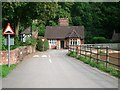
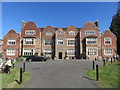
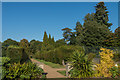
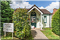
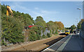
63 photos from this area
Area Information
Key information about the RH4 3DS including its size, population, and administrative classification.
- Area Type
- Postcode
- Area Size
- 1.9 hectares
- Population
- 1926
- Population Density
- 6524 people/km²
House Prices in RH4 3DS
22
Properties
£480,069
Average Sold Price
£169,950
Lowest Price
£815,000
Highest Price
Showing 22 properties
| Address | Type | Beds | Baths | Last Sale Price | Last Sale Date | |
|---|---|---|---|---|---|---|
| 27 Glebe Road, Dorking, RH4 3DS | Bungalow | 2 | - | £552,500 | Jul 2019 | |
| 21 Glebe Road, Dorking, RH4 3DS | house | - | - | £658,446 | Jul 2017 | |
| 39 Glebe Road, Dorking, RH4 3DS | house | - | - | £815,000 | Jul 2015 | |
| 9 Glebe Road, Dorking, RH4 3DS | Detached | 5 | - | £730,000 | Jan 2014 | |
| 15 Glebe Road, Dorking, RH4 3DS | Detached | 3 | - | £545,000 | Dec 2013 | |
| 5 Glebe Road, Dorking, RH4 3DS | house | 3 | - | £515,000 | Sep 2012 | |
| 15A Glebe Road, Dorking, RH4 3DS | house | - | - | £495,000 | Sep 2012 | |
| 11 Glebe Road, Dorking, RH4 3DS | Detached | 3 | - | £484,000 | Aug 2012 | |
| 37 Glebe Road, Dorking, RH4 3DS | house | 3 | - | £450,000 | Oct 2011 | |
| 25 Glebe Road, Dorking, RH4 3DS | Semi-detached | - | - | £330,000 | Jun 2009 |
Page 1 of 3
Energy Efficiency in RH4 3DS
Amenities
Schools
| Rank | School | Type | Entry gender | Ages |
|---|
Explore more schools in this area
Go to Schools tabDemographics
Household Size
Family (3-5 people)
most common
Accommodation Type
Houses
most common
Tenure
56
majority
Ethnic Group
White
most common
Religion
N/A
most common
Household Composition
N/A
most common
Age
47
median
Adults (30-64 years)
most common
Household Deprivation
N/A
with no deprivation
NS-SEC
40
in Lower managerial occupations
Explore more demographic insights in this area
Go to Demographics tabPlanning
Planning Constraints
- Flood RiskPremium
- Ramsar Wetland SitesPremium
- Area of Outstanding Natural BeautyPremium
- Protected Nature ReservePremium
- Protected WoodlandPremium