Area Overview for RH4 2PN
Photos of RH4 2PN
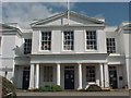
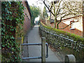
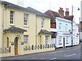

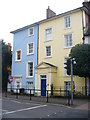

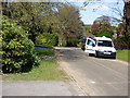
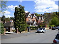
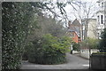
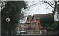
99 photos from this area
Area Information
Key information about the RH4 2PN including its size, population, and administrative classification.
- Area Type
- Postcode
- Area Size
- 1.3 hectares
- Population
- 1552
- Population Density
- 1399 people/km²
House Prices in RH4 2PN
9
Properties
£596,200
Average Sold Price
£159,000
Lowest Price
£895,000
Highest Price
Showing 9 properties
| Address | Type | Beds | Baths | Last Sale Price | Last Sale Date | |
|---|---|---|---|---|---|---|
| Crossfield, Martineau Drive, Dorking, RH4 2PN | Bungalow | 3 | 2 | £675,000 | Jun 2024 | |
| Southwood, Martineau Drive, Dorking, RH4 2PN | house | - | - | £895,000 | Jul 2022 | |
| Woodlands, Martineau Drive, Dorking, RH4 2PN | Land | - | - | £650,000 | Jan 2012 | |
| Hamar, Martineau Drive, Dorking, RH4 2PN | Detached | - | - | £602,000 | May 2006 | |
| Cotswolds, Martineau Drive, Dorking, RH4 2PN | Detached | - | - | £159,000 | Jan 1998 | |
| The Lodge, Martineau Drive, Dorking, RH4 2PN | Detached | - | - | - | - | |
| The Holly Bush, Martineau Drive, Dorking, RH4 2PN | Detached | - | - | - | - | |
| Chadwell House, Martineau Drive, Dorking, RH4 2PN | Unknown | - | - | - | - | |
| Sunflowers, Martineau Drive, Dorking, RH4 2PN | house | 3 | - | - | - |
Energy Efficiency in RH4 2PN
Amenities
Schools
| Rank | School | Type | Entry gender | Ages |
|---|
Explore more schools in this area
Go to Schools tabDemographics
Household Size
Family (3-5 people)
most common
Accommodation Type
Houses
most common
Tenure
65
majority
Ethnic Group
White
most common
Religion
N/A
most common
Household Composition
N/A
most common
Age
47
median
Adults (30-64 years)
most common
Household Deprivation
N/A
with no deprivation
NS-SEC
33
in Lower managerial occupations
Explore more demographic insights in this area
Go to Demographics tabPlanning
Planning Constraints
- Flood RiskPremium
- Ramsar Wetland SitesPremium
- Area of Outstanding Natural BeautyPremium
- Protected Nature ReservePremium
- Protected WoodlandPremium