Area Overview for RH4 1PT
Photos of RH4 1PT
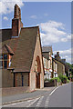
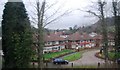
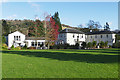
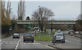

100 photos from this area
Area Information
Key information about the RH4 1PT including its size, population, and administrative classification.
- Area Type
- Postcode
- Area Size
- 1.4 hectares
- Population
- 1891
- Population Density
- 169 people/km²
House Prices in RH4 1PT
25
Properties
£527,546
Average Sold Price
£78,000
Lowest Price
£1,310,000
Highest Price
Showing 25 properties
| Address | Type | Beds | Baths | Last Sale Price | Last Sale Date | |
|---|---|---|---|---|---|---|
| 38 Pixham Lane, Pixham, Dorking, RH4 1PT | Semi-detached | 3 | 1 | £495,750 | Jan 2023 | |
| 30 Pixham Lane, Pixham, Dorking, RH4 1PT | Retail | 3 | 1 | £430,000 | Aug 2022 | |
| 46 Pixham Lane, Pixham, Dorking, RH4 1PT | Retail | 2 | 1 | £405,000 | Jun 2022 | |
| 36 Pixham Lane, Pixham, Dorking, RH4 1PT | Semi-detached | 4 | 2 | £510,000 | Jan 2020 | |
| Yew Tree Cottage, Pixham Lane, Pixham, Dorking, RH4 1PT | Cottage | 4 | 2 | £670,000 | Dec 2019 | |
| 12A Pixham Lane, Pixham, Dorking, RH4 1PT | Semi-detached | 4 | 2 | £675,000 | Oct 2019 | |
| 34 Pixham Lane, Pixham, Dorking, RH4 1PT | Semi-detached | 3 | 2 | £491,257 | May 2017 | |
| 10 Pixham Lane, Pixham, Dorking, RH4 1PT | house | 6 | 2 | £1,310,000 | Jul 2014 | |
| 22 Pixham Lane, Pixham, Dorking, RH4 1PT | Semi-detached | 5 | - | £590,000 | Aug 2013 | |
| 28 Pixham Lane, Pixham, Dorking, RH4 1PT | Terraced | - | - | £148,000 | Sep 2000 |
Page 1 of 3
Energy Efficiency in RH4 1PT
Amenities
Schools
| Rank | School | Type | Entry gender | Ages |
|---|
Explore more schools in this area
Go to Schools tabDemographics
Household Size
Two person
most common
Accommodation Type
Houses
most common
Tenure
79
majority
Ethnic Group
White
most common
Religion
N/A
most common
Household Composition
N/A
most common
Age
47
median
Adults (30-64 years)
most common
Household Deprivation
N/A
with no deprivation
NS-SEC
53
in Lower managerial occupations
Explore more demographic insights in this area
Go to Demographics tabPlanning
Planning Constraints
- Flood RiskPremium
- Ramsar Wetland SitesPremium
- Area of Outstanding Natural BeautyPremium
- Protected Nature ReservePremium
- Protected WoodlandPremium