Area Overview for RH20 4JL
Photos of RH20 4JL
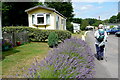
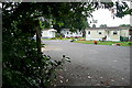
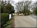
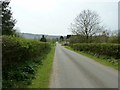
41 photos from this area
Area Information
Key information about the RH20 4JL including its size, population, and administrative classification.
- Area Type
- Postcode
- Area Size
- 1.2 hectares
- Population
- 1705
- Population Density
- 2172 people/km²
House Prices in RH20 4JL
14
Properties
£435,355
Average Sold Price
£178,000
Lowest Price
£675,550
Highest Price
Showing 14 properties
| Address | Type | Beds | Baths | Last Sale Price | Last Sale Date | |
|---|---|---|---|---|---|---|
| Deri, 13 Fox Court, Storrington, RH20 4JL | house | - | - | £675,550 | Jun 2022 | |
| Tree Tops, 7 Fox Court, Storrington, RH20 4JL | house | - | - | £640,000 | Jun 2022 | |
| Cherries, 14 Fox Court, Storrington, RH20 4JL | house | - | - | £472,500 | Jun 2015 | |
| Hunters Cottage, 11 Fox Court, Storrington, RH20 4JL | Bungalow | 3 | - | £472,500 | Sep 2014 | |
| 12 Fox Court, Storrington, RH20 4JL | Detached | 3 | 1 | £460,000 | Mar 2014 | |
| 5 Fox Court, Storrington, RH20 4JL | house | - | - | £390,000 | Oct 2012 | |
| Green Sands, 1 Fox Court, Storrington, RH20 4JL | house | - | - | £386,000 | Apr 2012 | |
| White Gables, 10 Fox Court, Storrington, RH20 4JL | Detached | - | - | £445,000 | May 2008 | |
| Rosemullion, 9 Fox Court, Storrington, RH20 4JL | Detached | - | - | £234,000 | Dec 2000 | |
| Furze Wood, 4 Fox Court, Storrington, RH20 4JL | Detached | - | - | £178,000 | Jul 1998 |
Page 1 of 2
Energy Efficiency in RH20 4JL
Amenities
Schools
| Rank | School | Type | Entry gender | Ages |
|---|
Explore more schools in this area
Go to Schools tabDemographics
Household Size
One person
most common
Accommodation Type
Houses
most common
Tenure
75
majority
Ethnic Group
White
most common
Religion
N/A
most common
Household Composition
N/A
most common
Age
47
median
Elderly (65+ years)
most common
Household Deprivation
N/A
with no deprivation
NS-SEC
39
in Lower managerial occupations
Explore more demographic insights in this area
Go to Demographics tabPlanning
Planning Constraints
- Flood RiskPremium
- Ramsar Wetland SitesPremium
- Area of Outstanding Natural BeautyPremium
- Protected Nature ReservePremium
- Protected WoodlandPremium