Area Overview for RH20 4HJ
Photos of RH20 4HJ
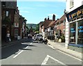


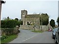

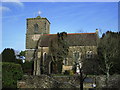
100 photos from this area
Area Information
Key information about the RH20 4HJ including its size, population, and administrative classification.
- Area Type
- Postcode
- Area Size
- 5.6 hectares
- Population
- 1873
- Population Density
- 844 people/km²
House Prices in RH20 4HJ
35
Properties
£442,238
Average Sold Price
£114,000
Lowest Price
£940,000
Highest Price
Showing 35 properties
| Address | Type | Beds | Baths | Last Sale Price | Last Sale Date | |
|---|---|---|---|---|---|---|
| Fieldings, 39 Pulborough Road, Storrington, RH20 4HJ | Semi-detached | 3 | 1 | £820,000 | May 2024 | |
| 47 Pulborough Road, Storrington, RH20 4HJ | Detached | 4 | 2 | £835,000 | May 2024 | |
| 53 Pulborough Road, Storrington, RH20 4HJ | Detached | 5 | - | £940,000 | Apr 2022 | |
| Carousel, 41 Pulborough Road, Storrington, RH20 4HJ | house | - | - | £550,000 | Mar 2022 | |
| 35 Pulborough Road, Storrington, RH20 4HJ | Bungalow | 2 | - | £440,000 | Aug 2021 | |
| 33 Pulborough Road, Storrington, RH20 4HJ | Semi-detached | 3 | - | £485,000 | Feb 2021 | |
| 43 Pulborough Road, Storrington, RH20 4HJ | Semi-detached | 3 | 1 | £430,000 | Jan 2021 | |
| Hormare Cottage, Pulborough Road, Storrington, RH20 4HJ | house | - | - | £825,000 | Dec 2020 | |
| 17 Pulborough Road, Storrington, RH20 4HJ | Detached | 4 | 3 | £410,000 | May 2016 | |
| Sliabh Na Breaca, 49 Pulborough Road, Storrington, RH20 4HJ | Detached | 4 | 3 | £535,000 | Nov 2014 |
Page 1 of 4
Energy Efficiency in RH20 4HJ
Amenities
Schools
| Rank | School | Type | Entry gender | Ages |
|---|
Explore more schools in this area
Go to Schools tabDemographics
Household Size
Two person
most common
Accommodation Type
Houses
most common
Tenure
91
majority
Ethnic Group
White
most common
Religion
N/A
most common
Household Composition
N/A
most common
Age
47
median
Adults (30-64 years)
most common
Household Deprivation
N/A
with no deprivation
NS-SEC
51
in Lower managerial occupations
Explore more demographic insights in this area
Go to Demographics tabPlanning
Planning Constraints
- Flood RiskPremium
- Ramsar Wetland SitesPremium
- Area of Outstanding Natural BeautyPremium
- Protected Nature ReservePremium
- Protected WoodlandPremium