Area Overview for RH20 4EQ
Photos of RH20 4EQ
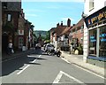
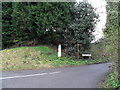
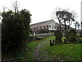
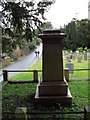

100 photos from this area
Area Information
Key information about the RH20 4EQ including its size, population, and administrative classification.
- Area Type
- Postcode
- Area Size
- 3.4 hectares
- Population
- 1679
- Population Density
- 3029 people/km²
House Prices in RH20 4EQ
61
Properties
£218,955
Average Sold Price
£88,000
Lowest Price
£355,000
Highest Price
Showing 61 properties
| Address | Type | Beds | Baths | Last Sale Price | Last Sale Date | |
|---|---|---|---|---|---|---|
| 41 Meadowside, Storrington, RH20 4EQ | Semi-detached | 2 | 2 | £355,000 | Jan 2024 | |
| 88 Meadowside, Storrington, RH20 4EQ | Flat | - | - | £210,000 | Jan 2024 | |
| 76 Meadowside, Storrington, RH20 4EQ | Flat | - | - | £170,000 | Mar 2023 | |
| 92 Meadowside, Storrington, RH20 4EQ | house | - | - | £280,500 | Jun 2021 | |
| 38 Meadowside, Storrington, RH20 4EQ | house | - | - | £325,000 | Dec 2020 | |
| 95 Meadowside, Storrington, RH20 4EQ | house | - | - | £299,000 | May 2018 | |
| 40 Meadowside, Storrington, RH20 4EQ | house | - | - | £275,000 | Jan 2017 | |
| 42 Meadowside, Storrington, RH20 4EQ | house | - | - | £155,000 | Aug 2011 | |
| 72 Meadowside, Storrington, RH20 4EQ | Flat | - | - | £126,000 | Sep 2007 | |
| 71 Meadowside, Storrington, RH20 4EQ | Flat | - | - | £125,000 | Aug 2006 |
Page 1 of 7
Energy Efficiency in RH20 4EQ
Amenities
Schools
| Rank | School | Type | Entry gender | Ages |
|---|
Explore more schools in this area
Go to Schools tabDemographics
Household Size
One person
most common
Accommodation Type
Houses
most common
Tenure
50
majority
Ethnic Group
White
most common
Religion
N/A
most common
Household Composition
N/A
most common
Age
47
median
Adults (30-64 years)
most common
Household Deprivation
N/A
with no deprivation
NS-SEC
33
in Lower managerial occupations
Explore more demographic insights in this area
Go to Demographics tabPlanning
Planning Constraints
- Flood RiskPremium
- Ramsar Wetland SitesPremium
- Area of Outstanding Natural BeautyPremium
- Protected Nature ReservePremium
- Protected WoodlandPremium