Area Overview for RH20 2NP
Photos of RH20 2NP
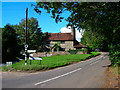
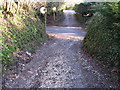
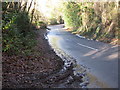

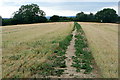

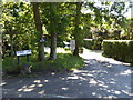
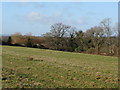
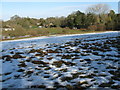
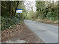

24 photos from this area
Area Information
Key information about the RH20 2NP including its size, population, and administrative classification.
- Area Type
- Postcode
- Area Size
- 1.9 hectares
- Population
- 1707
- Population Density
- 892 people/km²
House Prices in RH20 2NP
10
Properties
£598,688
Average Sold Price
£215,000
Lowest Price
£1,325,000
Highest Price
Showing 10 properties
| Address | Type | Beds | Baths | Last Sale Price | Last Sale Date | |
|---|---|---|---|---|---|---|
| Mizpah, 5 Wyndham Lea, West Chiltington, RH20 2NP | Detached | 4 | 3 | £1,325,000 | Sep 2025 | |
| The Firs, 6 Wyndham Lea, West Chiltington, RH20 2NP | Bungalow | - | - | £675,000 | Dec 2020 | |
| Greensands, Wyndham Lea, West Chiltington, RH20 2NP | Detached | 3 | 3 | £650,000 | Jun 2018 | |
| Cymbula, 8 Wyndham Lea, West Chiltington, RH20 2NP | Bungalow | - | - | £590,000 | Jan 2017 | |
| 4 Wyndham Lea, West Chiltington, RH20 2NP | Bungalow | - | - | £712,000 | Sep 2015 | |
| Wagtails, 3 Wyndham Lea, West Chiltington, RH20 2NP | Detached | - | - | £382,000 | Dec 2000 | |
| Lynmore, 7 Wyndham Lea, West Chiltington, RH20 2NP | Detached | - | - | £215,000 | Dec 1997 | |
| 2 Wyndham Lea, West Chiltington, RH20 2NP | Detached | - | - | £240,500 | Nov 1996 | |
| Wyndham Lea House, 1 Wyndham Lea, West Chiltington, RH20 2NP | house | 4 | - | - | - | |
| Little Warren, Wyndham Lea, West Chiltington, RH20 2NP | house | - | - | - | - |
Energy Efficiency in RH20 2NP
Amenities
Schools
| Rank | School | Type | Entry gender | Ages |
|---|
Explore more schools in this area
Go to Schools tabDemographics
Household Size
Two person
most common
Accommodation Type
Houses
most common
Tenure
96
majority
Ethnic Group
White
most common
Religion
N/A
most common
Household Composition
N/A
most common
Age
70
median
Elderly (65+ years)
most common
Household Deprivation
N/A
with no deprivation
NS-SEC
56
in Lower managerial occupations
Explore more demographic insights in this area
Go to Demographics tabPlanning
Planning Constraints
- Flood RiskPremium
- Ramsar Wetland SitesPremium
- Area of Outstanding Natural BeautyPremium
- Protected Nature ReservePremium
- Protected WoodlandPremium