Area Overview for RH20 2NJ
Photos of RH20 2NJ
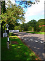
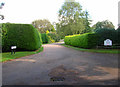
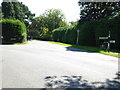
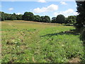
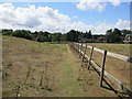


14 photos from this area
Area Information
Key information about the RH20 2NJ including its size, population, and administrative classification.
- Area Type
- Postcode
- Area Size
- 6.4 hectares
- Population
- 1707
- Population Density
- 892 people/km²
House Prices in RH20 2NJ
22
Properties
£582,679
Average Sold Price
£190,000
Lowest Price
£1,200,000
Highest Price
Showing 22 properties
| Address | Type | Beds | Baths | Last Sale Price | Last Sale Date | |
|---|---|---|---|---|---|---|
| Arborfield, Castlegate, West Chiltington, RH20 2NJ | Detached | 4 | 2 | £765,000 | Jul 2025 | |
| Little Foxes, Castlegate, West Chiltington, RH20 2NJ | Bungalow | 4 | 3 | £1,200,000 | Sep 2023 | |
| Lewa Downs, Castlegate, West Chiltington, RH20 2NJ | Detached | 4 | - | £1,000,000 | Oct 2021 | |
| The Oaks, Castlegate, West Chiltington, RH20 2NJ | Bungalow | 3 | - | £830,000 | Feb 2014 | |
| Little Hadlow, Castlegate, West Chiltington, RH20 2NJ | Detached | 3 | - | £585,000 | Feb 2014 | |
| Blue Cedar, Castlegate, West Chiltington, RH20 2NJ | house | - | - | £532,000 | May 2007 | |
| Langdale, Castlegate, West Chiltington, RH20 2NJ | Detached | - | - | £560,000 | May 2006 | |
| High Rising, Castlegate, West Chiltington, RH20 2NJ | Detached | 4 | 3 | £570,000 | Dec 2005 | |
| 1 Castlegate, West Chiltington, RH20 2NJ | Bungalow | 3 | - | £490,000 | Jun 2005 | |
| Burchetts, Castlegate, West Chiltington, RH20 2NJ | Bungalow | - | - | £370,000 | Jul 2002 |
Page 1 of 3
Energy Efficiency in RH20 2NJ
Amenities
Schools
| Rank | School | Type | Entry gender | Ages |
|---|
Explore more schools in this area
Go to Schools tabDemographics
Household Size
Two person
most common
Accommodation Type
Houses
most common
Tenure
96
majority
Ethnic Group
White
most common
Religion
N/A
most common
Household Composition
N/A
most common
Age
70
median
Elderly (65+ years)
most common
Household Deprivation
N/A
with no deprivation
NS-SEC
56
in Lower managerial occupations
Explore more demographic insights in this area
Go to Demographics tabPlanning
Planning Constraints
- Flood RiskPremium
- Ramsar Wetland SitesPremium
- Area of Outstanding Natural BeautyPremium
- Protected Nature ReservePremium
- Protected WoodlandPremium