Area Overview for RH20 2JN
Photos of RH20 2JN

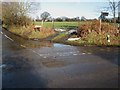

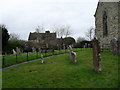

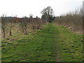
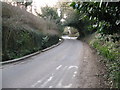
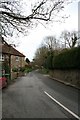
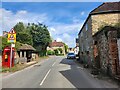
85 photos from this area
Area Information
Key information about the RH20 2JN including its size, population, and administrative classification.
- Area Type
- Postcode
- Area Size
- 7.3 hectares
- Population
- 1709
- Population Density
- 111 people/km²
House Prices in RH20 2JN
13
Properties
£492,206
Average Sold Price
£178,500
Lowest Price
£880,000
Highest Price
Showing 13 properties
| Address | Type | Beds | Baths | Last Sale Price | Last Sale Date | |
|---|---|---|---|---|---|---|
| Lakers Croft, The Hollow, West Chiltington, RH20 2JN | Detached | 4 | 2 | £650,000 | Nov 2021 | |
| High Hollow, The Hollow, West Chiltington, RH20 2JN | Bungalow | 2 | - | £445,000 | Dec 2014 | |
| Palmers, The Hollow, West Chiltington, RH20 2JN | house | 3 | - | £880,000 | Sep 2014 | |
| Easebourne House, The Hollow, West Chiltington, RH20 2JN | house | 3 | - | £380,000 | May 2012 | |
| Hunters Barn, The Hollow, West Chiltington, RH20 2JN | Detached | - | - | £488,000 | Dec 2009 | |
| Southdown, The Hollow, West Chiltington, RH20 2JN | Detached | 2 | - | £763,400 | Jan 2008 | |
| Crowhurst, The Hollow, West Chiltington, RH20 2JN | Detached | 4 | 2 | £410,000 | May 2007 | |
| Knowlers, The Hollow, West Chiltington, RH20 2JN | Detached | - | - | £234,950 | Sep 1998 | |
| Charta House, The Hollow, West Chiltington, RH20 2JN | Detached | - | - | £178,500 | Nov 1996 | |
| Caravan, Cockingstead Farm, The Hollow, West Chiltington, RH20 2JN | Mobile Home | - | - | - | - |
Page 1 of 2
Energy Efficiency in RH20 2JN
Amenities
Schools
| Rank | School | Type | Entry gender | Ages |
|---|
Explore more schools in this area
Go to Schools tabDemographics
Household Size
Two person
most common
Accommodation Type
Houses
most common
Tenure
85
majority
Ethnic Group
White
most common
Religion
N/A
most common
Household Composition
N/A
most common
Age
47
median
Adults (30-64 years)
most common
Household Deprivation
N/A
with no deprivation
NS-SEC
49
in Lower managerial occupations
Explore more demographic insights in this area
Go to Demographics tabPlanning
Planning Constraints
- Flood RiskPremium
- Ramsar Wetland SitesPremium
- Area of Outstanding Natural BeautyPremium
- Protected Nature ReservePremium
- Protected WoodlandPremium