Area Overview for RH20 2HB
Photos of RH20 2HB
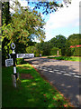
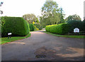
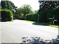
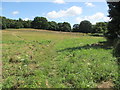
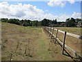


14 photos from this area
Area Information
Key information about the RH20 2HB including its size, population, and administrative classification.
- Area Type
- Postcode
- Area Size
- 8.9 hectares
- Population
- 1601
- Population Density
- 87 people/km²
House Prices in RH20 2HB
12
Properties
£632,999
Average Sold Price
£400,000
Lowest Price
£799,995
Highest Price
Showing 12 properties
| Address | Type | Beds | Baths | Last Sale Price | Last Sale Date | |
|---|---|---|---|---|---|---|
| Twitten Orchard, Nutbourne Common, Pulborough, RH20 2HB | Bungalow | - | - | £655,000 | Aug 2023 | |
| Tinkers Green, Nutbourne Common, Pulborough, RH20 2HB | Detached | - | - | £799,995 | Jun 2021 | |
| The Old Pump House, Nutbourne Common, Pulborough, RH20 2HB | Detached | 4 | 3 | £745,000 | Dec 2020 | |
| Goat Cottage, Nutbourne Common, Pulborough, RH20 2HB | house | 3 | - | £565,000 | May 2017 | |
| Horsecroft Tanners, Nutbourne Common, Pulborough, RH20 2HB | Detached | - | - | £400,000 | Mar 2001 | |
| Nutbourne Ridge, Nutbourne Common, Pulborough, RH20 2HB | Detached | 5 | 2 | - | - | |
| Annexe, Tinkers Green, Nutbourne Common, Pulborough, RH20 2HB | Detached | - | - | - | - | |
| 2, Malthouse Cottages, Nutbourne Common, Pulborough, RH20 2HB | Terraced | - | - | - | - | |
| Old Malthouse, Nutbourne Common, Pulborough, RH20 2HB | house | 3 | - | - | - | |
| The Rosary, Nutbourne Common, Pulborough, RH20 2HB | Semi-detached | - | - | - | - |
Page 1 of 2
Energy Efficiency in RH20 2HB
Amenities
Schools
| Rank | School | Type | Entry gender | Ages |
|---|
Explore more schools in this area
Go to Schools tabDemographics
Household Size
Two person
most common
Accommodation Type
Houses
most common
Tenure
83
majority
Ethnic Group
White
most common
Religion
N/A
most common
Household Composition
N/A
most common
Age
47
median
Adults (30-64 years)
most common
Household Deprivation
N/A
with no deprivation
NS-SEC
45
in Lower managerial occupations
Explore more demographic insights in this area
Go to Demographics tabPlanning
Planning Constraints
- Flood RiskPremium
- Ramsar Wetland SitesPremium
- Area of Outstanding Natural BeautyPremium
- Protected Nature ReservePremium
- Protected WoodlandPremium