Area Overview for RH20 1EL
Photos of RH20 1EL
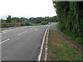
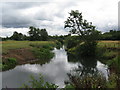
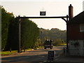
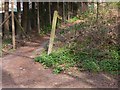
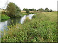
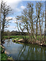
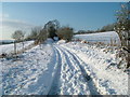
53 photos from this area
Area Information
Key information about the RH20 1EL including its size, population, and administrative classification.
- Area Type
- Postcode
- Area Size
- 10.6 hectares
- Population
- 1505
- Population Density
- 58 people/km²
House Prices in RH20 1EL
10
Properties
£333,813
Average Sold Price
£160,000
Lowest Price
£940,000
Highest Price
Showing 10 properties
| Address | Type | Beds | Baths | Last Sale Price | Last Sale Date | |
|---|---|---|---|---|---|---|
| 1, St Richards Cottages, Lower Street, Fittleworth, RH20 1EL | house | - | - | £240,000 | Nov 2021 | |
| 3, St Richards Cottages, Lower Street, Fittleworth, RH20 1EL | Terraced | 1 | 1 | £227,000 | Sep 2021 | |
| Street House, Lower Street, Fittleworth, RH20 1EL | Detached | 4 | 2 | £940,000 | Jan 2017 | |
| 5, St Richards Cottages, Lower Street, Fittleworth, RH20 1EL | Cottage | 2 | - | £233,500 | Mar 2016 | |
| 2, St Richards Cottages, Lower Street, Fittleworth, RH20 1EL | house | 2 | - | £219,000 | May 2012 | |
| Baddow Cottage, Lower Street, Fittleworth, RH20 1EL | house | 3 | - | £485,000 | May 2011 | |
| 4, St Richards Cottages, Lower Street, Fittleworth, RH20 1EL | Cottage | 2 | 1 | £166,000 | Sep 2005 | |
| Bankywood, Lower Street, Fittleworth, RH20 1EL | house | - | - | £160,000 | Sep 1996 | |
| 6, St Richards Cottages, Lower Street, Fittleworth, RH20 1EL | Terraced | - | - | - | - | |
| Hillcrest, Lower Street, Fittleworth, RH20 1EL | Detached | - | - | - | - |
Energy Efficiency in RH20 1EL
Amenities
Schools
| Rank | School | Type | Entry gender | Ages |
|---|
Explore more schools in this area
Go to Schools tabDemographics
Household Size
Two person
most common
Accommodation Type
Houses
most common
Tenure
71
majority
Ethnic Group
White
most common
Religion
N/A
most common
Household Composition
N/A
most common
Age
47
median
Adults (30-64 years)
most common
Household Deprivation
N/A
with no deprivation
NS-SEC
44
in Lower managerial occupations
Explore more demographic insights in this area
Go to Demographics tabPlanning
Planning Constraints
- Flood RiskPremium
- Ramsar Wetland SitesPremium
- Area of Outstanding Natural BeautyPremium
- Protected Nature ReservePremium
- Protected WoodlandPremium