Area Overview for RH2 9JH
Photos of RH2 9JH
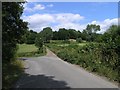
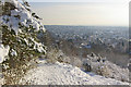
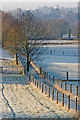
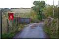
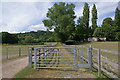
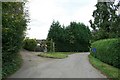
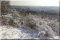
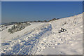
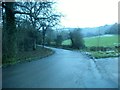
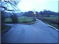
100 photos from this area
Area Information
Key information about the RH2 9JH including its size, population, and administrative classification.
- Area Type
- Postcode
- Area Size
- 11.3 hectares
- Population
- 1072
- Population Density
- 515 people/km²
House Prices in RH2 9JH
22
Properties
£992,063
Average Sold Price
£430,000
Lowest Price
£1,500,000
Highest Price
Showing 22 properties
| Address | Type | Beds | Baths | Last Sale Price | Last Sale Date | |
|---|---|---|---|---|---|---|
| Little Owl Corner, Colley Way, Reigate, RH2 9JH | Detached | 5 | 2 | £1,403,000 | Oct 2022 | |
| Langdale Cottage, Colley Way, Reigate, RH2 9JH | Detached | - | - | £1,500,000 | Jul 2022 | |
| Gwynfryn, Colley Way, Reigate, RH2 9JH | house | - | - | £1,220,000 | Apr 2021 | |
| Budleigh, Colley Way, Reigate, RH2 9JH | house | 4 | 2 | £1,480,000 | Nov 2019 | |
| Juniper, Colley Way, Reigate, RH2 9JH | Detached | 4 | 1 | £1,228,000 | Jul 2016 | |
| The Orchard, Colley Way, Reigate, RH2 9JH | house | 4 | - | £1,200,000 | Sep 2013 | |
| Mole End, Colley Way, Reigate, RH2 9JH | house | 4 | - | £974,000 | Apr 2012 | |
| Brown Owl Cottage, Colley Way, Reigate, RH2 9JH | house | - | - | £830,000 | Jul 2011 | |
| Red Cottage, Colley Way, Reigate, RH2 9JH | Detached | - | - | £1,100,000 | Jul 2010 | |
| The Laurels, Colley Way, Reigate, RH2 9JH | house | - | - | £1,065,000 | Jun 2009 |
Page 1 of 3
Energy Efficiency in RH2 9JH
Amenities
Schools
| Rank | School | Type | Entry gender | Ages |
|---|
Explore more schools in this area
Go to Schools tabDemographics
Household Size
Two person
most common
Accommodation Type
Houses
most common
Tenure
83
majority
Ethnic Group
White
most common
Religion
N/A
most common
Household Composition
N/A
most common
Age
47
median
Adults (30-64 years)
most common
Household Deprivation
N/A
with no deprivation
NS-SEC
60
in Lower managerial occupations
Explore more demographic insights in this area
Go to Demographics tabPlanning
Planning Constraints
- Flood RiskPremium
- Ramsar Wetland SitesPremium
- Area of Outstanding Natural BeautyPremium
- Protected Nature ReservePremium
- Protected WoodlandPremium