Area Overview for RH2 9DG
Photos of RH2 9DG
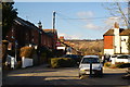
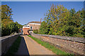
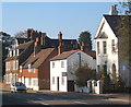
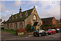
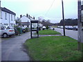
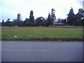
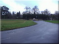
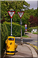
100 photos from this area
Area Information
Key information about the RH2 9DG including its size, population, and administrative classification.
- Area Type
- Postcode
- Area Size
- 3.3 hectares
- Population
- 2302
- Population Density
- 489 people/km²
House Prices in RH2 9DG
34
Properties
£733,155
Average Sold Price
£185,000
Lowest Price
£1,650,000
Highest Price
Showing 34 properties
| Address | Type | Beds | Baths | Last Sale Price | Last Sale Date | |
|---|---|---|---|---|---|---|
| 8 Beaufort Close, Reigate, RH2 9DG | Detached | 6 | 3 | £1,650,000 | Feb 2025 | |
| 19 Beaufort Close, Reigate, RH2 9DG | Detached | 4 | 3 | £1,210,000 | Feb 2025 | |
| 27 Beaufort Close, Reigate, RH2 9DG | Detached | 4 | 3 | £1,225,000 | Feb 2024 | |
| 10 Beaufort Close, Reigate, RH2 9DG | house | 5 | - | £1,220,000 | Sep 2021 | |
| 13 Beaufort Close, Reigate, RH2 9DG | house | - | - | £1,258,200 | Jun 2021 | |
| 36 Beaufort Close, Reigate, RH2 9DG | house | - | - | £1,060,000 | Mar 2021 | |
| 21A Beaufort Close, Reigate, RH2 9DG | Detached | 4 | 2 | £830,000 | Aug 2014 | |
| 11 Beaufort Close, Reigate, RH2 9DG | Detached | 4 | - | £737,500 | May 2013 | |
| 22 Beaufort Close, Reigate, RH2 9DG | Detached | 5 | 2 | £640,000 | Jan 2012 | |
| 23 Beaufort Close, Reigate, RH2 9DG | house | 3 | - | £500,000 | Aug 2011 |
Page 1 of 4
Energy Efficiency in RH2 9DG
Amenities
Schools
| Rank | School | Type | Entry gender | Ages |
|---|
Explore more schools in this area
Go to Schools tabDemographics
Household Size
Family (3-5 people)
most common
Accommodation Type
Houses
most common
Tenure
84
majority
Ethnic Group
White
most common
Religion
N/A
most common
Household Composition
N/A
most common
Age
47
median
Adults (30-64 years)
most common
Household Deprivation
N/A
with no deprivation
NS-SEC
56
in Lower managerial occupations
Explore more demographic insights in this area
Go to Demographics tabPlanning
Planning Constraints
- Flood RiskPremium
- Ramsar Wetland SitesPremium
- Area of Outstanding Natural BeautyPremium
- Protected Nature ReservePremium
- Protected WoodlandPremium