Area Overview for RH2 0EX
Photos of RH2 0EX
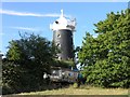
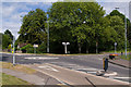
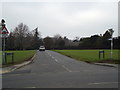
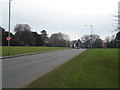
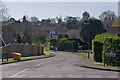
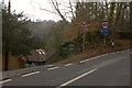
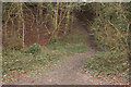
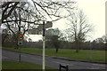
68 photos from this area
Area Information
Key information about the RH2 0EX including its size, population, and administrative classification.
- Area Type
- Postcode
- Area Size
- 4.3 hectares
- Population
- 1694
- Population Density
- 484 people/km²
House Prices in RH2 0EX
22
Properties
£1,070,417
Average Sold Price
£465,000
Lowest Price
£1,950,000
Highest Price
Showing 22 properties
| Address | Type | Beds | Baths | Last Sale Price | Last Sale Date | |
|---|---|---|---|---|---|---|
| Lamorna, 26 Gatton Road, Reigate, RH2 0EX | Detached | 5 | 3 | £1,950,000 | Dec 2024 | |
| 7 Gatton Road, Reigate, RH2 0EX | Terraced | 4 | 2 | £1,220,000 | Apr 2024 | |
| 28 Gatton Road, Reigate, RH2 0EX | house | - | - | £1,275,000 | Jun 2019 | |
| 14A Gatton Road, Reigate, RH2 0EX | Detached | 5 | - | £1,366,000 | Dec 2018 | |
| 24 Gatton Road, Reigate, RH2 0EX | Detached | 4 | - | £1,300,000 | Jul 2018 | |
| 9 Gatton Road, Reigate, RH2 0EX | Terraced | 5 | 4 | £1,450,000 | Sep 2015 | |
| Fern Bank, 18 Gatton Road, Reigate, RH2 0EX | Detached | 6 | 5 | £875,000 | May 2010 | |
| 3 Gatton Road, Reigate, RH2 0EX | Detached | 3 | 3 | £656,000 | Jan 2009 | |
| Cherry Trees, 16 Gatton Road, Reigate, RH2 0EX | Detached | - | - | £765,000 | Nov 2006 | |
| 13 Gatton Road, Reigate, RH2 0EX | Detached | - | - | £773,000 | Sep 2006 |
Page 1 of 3
Energy Efficiency in RH2 0EX
Amenities
Schools
| Rank | School | Type | Entry gender | Ages |
|---|
Explore more schools in this area
Go to Schools tabDemographics
Household Size
Family (3-5 people)
most common
Accommodation Type
Houses
most common
Tenure
88
majority
Ethnic Group
White
most common
Religion
N/A
most common
Household Composition
N/A
most common
Age
47
median
Adults (30-64 years)
most common
Household Deprivation
N/A
with no deprivation
NS-SEC
56
in Lower managerial occupations
Explore more demographic insights in this area
Go to Demographics tabPlanning
Planning Constraints
- Flood RiskPremium
- Ramsar Wetland SitesPremium
- Area of Outstanding Natural BeautyPremium
- Protected Nature ReservePremium
- Protected WoodlandPremium