Area Overview for RH19 4AY
Photos of RH19 4AY
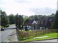

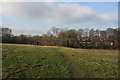
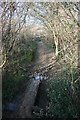
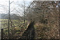


61 photos from this area
Area Information
Key information about the RH19 4AY including its size, population, and administrative classification.
- Area Type
- Postcode
- Area Size
- 9825 m²
- Population
- 1589
- Population Density
- 902 people/km²
House Prices in RH19 4AY
16
Properties
£299,411
Average Sold Price
£161,000
Lowest Price
£405,000
Highest Price
Showing 16 properties
| Address | Type | Beds | Baths | Last Sale Price | Last Sale Date | |
|---|---|---|---|---|---|---|
| 29 Faraday Avenue, East Grinstead, RH19 4AY | Semi-detached | 3 | 1 | £350,000 | Oct 2024 | |
| 31 Faraday Avenue, East Grinstead, RH19 4AY | Retail | 3 | 1 | £324,000 | Jul 2022 | |
| 3 Faraday Avenue, East Grinstead, RH19 4AY | house | - | - | £400,000 | Mar 2021 | |
| 13 Faraday Avenue, East Grinstead, RH19 4AY | Semi-detached | 3 | 1 | £405,000 | Aug 2020 | |
| 19 Faraday Avenue, East Grinstead, RH19 4AY | Semi-detached | 3 | - | £319,750 | Jul 2015 | |
| 11 Faraday Avenue, East Grinstead, RH19 4AY | Semi-detached | 4 | - | £299,950 | Jul 2012 | |
| 27 Faraday Avenue, East Grinstead, RH19 4AY | house | 3 | - | £195,000 | Aug 2011 | |
| 25 Faraday Avenue, East Grinstead, RH19 4AY | Semi-detached | - | - | £161,000 | Nov 2004 | |
| 17 Faraday Avenue, East Grinstead, RH19 4AY | house | - | - | £240,000 | Apr 2003 | |
| 7 Faraday Avenue, East Grinstead, RH19 4AY | Semi-detached | 5 | 2 | - | - |
Page 1 of 2
Energy Efficiency in RH19 4AY
Amenities
Schools
| Rank | School | Type | Entry gender | Ages |
|---|
Explore more schools in this area
Go to Schools tabDemographics
Household Size
Family (3-5 people)
most common
Accommodation Type
Houses
most common
Tenure
79
majority
Ethnic Group
White
most common
Religion
N/A
most common
Household Composition
N/A
most common
Age
47
median
Adults (30-64 years)
most common
Household Deprivation
N/A
with no deprivation
NS-SEC
36
in Lower managerial occupations
Explore more demographic insights in this area
Go to Demographics tabPlanning
Planning Constraints
- Flood RiskPremium
- Ramsar Wetland SitesPremium
- Area of Outstanding Natural BeautyPremium
- Protected Nature ReservePremium
- Protected WoodlandPremium