Area Overview for RH19 3UF
Photos of RH19 3UF
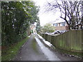
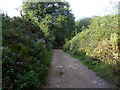
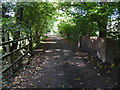
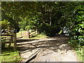
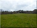
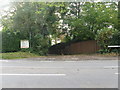
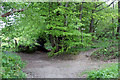
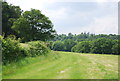
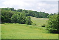
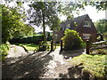
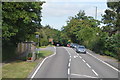
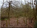
29 photos from this area
Area Information
Key information about the RH19 3UF including its size, population, and administrative classification.
- Area Type
- Postcode
- Area Size
- 22.1 hectares
- Population
- 1437
- Population Density
- 382 people/km²
House Prices in RH19 3UF
16
Properties
£604,333
Average Sold Price
£250,000
Lowest Price
£800,000
Highest Price
Showing 16 properties
| Address | Type | Beds | Baths | Last Sale Price | Last Sale Date | |
|---|---|---|---|---|---|---|
| Wavertree, Worsted Lane, East Grinstead, RH19 3UF | Detached | 5 | 4 | £756,000 | Oct 2025 | |
| Three Trees, Worsted Lane, East Grinstead, RH19 3UF | house | - | - | £800,000 | Mar 2021 | |
| Rosehill, Worsted Lane, East Grinstead, RH19 3UF | Detached | 4 | - | £635,000 | Apr 2018 | |
| Greenways, Worsted Lane, East Grinstead, RH19 3UF | Detached | 5 | 3 | £655,000 | Jun 2014 | |
| Worsted House, Worsted Lane, East Grinstead, RH19 3UF | house | - | - | £530,000 | Aug 2012 | |
| Worsted Farm Cottage, Worsted Lane, East Grinstead, RH19 3UF | house | - | - | £250,000 | Aug 1995 | |
| Worsted Farm, Worsted Lane, East Grinstead, RH19 3UF | Detached | 5 | 3 | - | - | |
| 2, Pond Barn, Worsted Lane, East Grinstead, RH19 3UF | Bungalow | - | - | - | - | |
| Tennis 60M From 1 Pond Barn, Worsted Lane 11M From Worsted Lane, Woodbury Close To Worsted Lane, East Grinstead, RH19 3UF | Leisure | - | - | - | - | |
| 1B, Pond Barn, Worsted Lane, East Grinstead, RH19 3UF | Bungalow | - | - | - | - |
Page 1 of 2
Energy Efficiency in RH19 3UF
Amenities
Schools
| Rank | School | Type | Entry gender | Ages |
|---|
Explore more schools in this area
Go to Schools tabDemographics
Household Size
Two person
most common
Accommodation Type
Houses
most common
Tenure
87
majority
Ethnic Group
White
most common
Religion
N/A
most common
Household Composition
N/A
most common
Age
47
median
Adults (30-64 years)
most common
Household Deprivation
N/A
with no deprivation
NS-SEC
43
in Lower managerial occupations
Explore more demographic insights in this area
Go to Demographics tabPlanning
Planning Constraints
- Flood RiskPremium
- Ramsar Wetland SitesPremium
- Area of Outstanding Natural BeautyPremium
- Protected Nature ReservePremium
- Protected WoodlandPremium