Area Overview for RH19 3EL
Photos of RH19 3EL
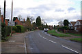
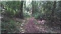
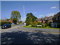
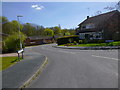
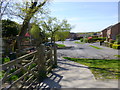
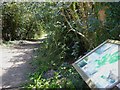
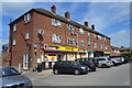
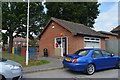

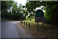
45 photos from this area
Area Information
Key information about the RH19 3EL including its size, population, and administrative classification.
- Area Type
- Postcode
- Area Size
- 1.1 hectares
- Population
- 1967
- Population Density
- 3935 people/km²
House Prices in RH19 3EL
33
Properties
£228,462
Average Sold Price
£55,000
Lowest Price
£425,000
Highest Price
Showing 33 properties
| Address | Type | Beds | Baths | Last Sale Price | Last Sale Date | |
|---|---|---|---|---|---|---|
| 30 Woodlands Road, East Grinstead, RH19 3EL | Semi-detached | 3 | 1 | £382,500 | Dec 2024 | |
| 44 Woodlands Road, East Grinstead, RH19 3EL | Semi-detached | 3 | 3 | £405,000 | Mar 2024 | |
| 26 Woodlands Road, East Grinstead, RH19 3EL | house | 3 | 1 | £425,000 | Jul 2022 | |
| 54 Woodlands Road, East Grinstead, RH19 3EL | Retail | 1 | 1 | £180,000 | May 2022 | |
| 66 Woodlands Road, East Grinstead, RH19 3EL | house | - | - | £287,500 | Feb 2015 | |
| 80 Woodlands Road, East Grinstead, RH19 3EL | house | - | - | £262,500 | Oct 2013 | |
| 18 Woodlands Road, East Grinstead, RH19 3EL | Terraced | 3 | - | £230,000 | Oct 2013 | |
| 78 Woodlands Road, East Grinstead, RH19 3EL | house | - | - | £220,000 | Nov 2012 | |
| 62 Woodlands Road, East Grinstead, RH19 3EL | Semi-detached | - | - | £186,000 | Aug 2009 | |
| 64 Woodlands Road, East Grinstead, RH19 3EL | Semi-detached | - | - | £177,000 | Jun 2004 |
Page 1 of 4
Energy Efficiency in RH19 3EL
Amenities
Schools
| Rank | School | Type | Entry gender | Ages |
|---|
Explore more schools in this area
Go to Schools tabDemographics
Household Size
Family (3-5 people)
most common
Accommodation Type
Houses
most common
Tenure
52
majority
Ethnic Group
White
most common
Religion
N/A
most common
Household Composition
N/A
most common
Age
47
median
Adults (30-64 years)
most common
Household Deprivation
N/A
with no deprivation
NS-SEC
29
in Lower managerial occupations
Explore more demographic insights in this area
Go to Demographics tabPlanning
Planning Constraints
- Flood RiskPremium
- Ramsar Wetland SitesPremium
- Area of Outstanding Natural BeautyPremium
- Protected Nature ReservePremium
- Protected WoodlandPremium