Area Overview for RH19 3ED
Photos of RH19 3ED
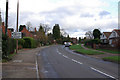
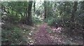
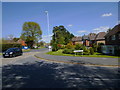
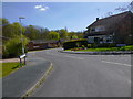
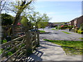
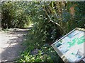
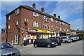
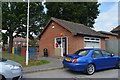

45 photos from this area
Area Information
Key information about the RH19 3ED including its size, population, and administrative classification.
- Area Type
- Postcode
- Area Size
- 7677 m²
- Population
- 2228
- Population Density
- 1006 people/km²
House Prices in RH19 3ED
21
Properties
£195,200
Average Sold Price
£47,000
Lowest Price
£379,000
Highest Price
Showing 21 properties
| Address | Type | Beds | Baths | Last Sale Price | Last Sale Date | |
|---|---|---|---|---|---|---|
| 131 Holtye Road, East Grinstead, RH19 3ED | Terraced | 3 | 1 | £379,000 | Sep 2023 | |
| 141 Holtye Road, East Grinstead, RH19 3ED | house | 3 | - | £308,000 | Apr 2021 | |
| 105 Holtye Road, East Grinstead, RH19 3ED | Terraced | 3 | 1 | £317,000 | Jul 2017 | |
| 109 Holtye Road, East Grinstead, RH19 3ED | Terraced | 3 | - | £262,500 | May 2015 | |
| 139 Holtye Road, East Grinstead, RH19 3ED | Semi-detached | 4 | - | £204,500 | Jun 2007 | |
| 101 Holtye Road, East Grinstead, RH19 3ED | Terraced | 3 | 1 | £227,500 | Jan 2007 | |
| 129 Holtye Road, East Grinstead, RH19 3ED | Terraced | - | - | £77,500 | Jan 1998 | |
| 119 Holtye Road, East Grinstead, RH19 3ED | Maisonette | 1 | 1 | £47,000 | Nov 1997 | |
| 127 Holtye Road, East Grinstead, RH19 3ED | Terraced | - | - | £65,000 | Jun 1997 | |
| 107 Holtye Road, East Grinstead, RH19 3ED | Terraced | - | - | £64,000 | Jan 1995 |
Page 1 of 3
Energy Efficiency in RH19 3ED
Amenities
Schools
| Rank | School | Type | Entry gender | Ages |
|---|
Explore more schools in this area
Go to Schools tabDemographics
Household Size
Family (3-5 people)
most common
Accommodation Type
Houses
most common
Tenure
88
majority
Ethnic Group
White
most common
Religion
N/A
most common
Household Composition
N/A
most common
Age
47
median
Adults (30-64 years)
most common
Household Deprivation
N/A
with no deprivation
NS-SEC
46
in Lower managerial occupations
Explore more demographic insights in this area
Go to Demographics tabPlanning
Planning Constraints
- Flood RiskPremium
- Ramsar Wetland SitesPremium
- Area of Outstanding Natural BeautyPremium
- Protected Nature ReservePremium
- Protected WoodlandPremium