Area Overview for RH19 2SA
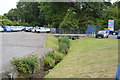
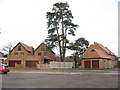
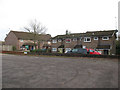
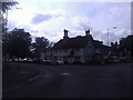
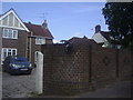
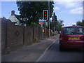
Photos of RH19 2SA


Area Information
Living in RH19 2SA offers a specific residential experience within a tightly defined cluster covering just 5,385 square metres. This small postcode area supports a population of 1,809 residents, creating a compact community where neighbourhood dynamics are immediate and personal. The area functions as a distinct residential pocket rather than a sprawling district, meaning daily routines often involve short walks to nearby services or reliance on public transport for longer commutes. With a population density of 335,964 people per square kilometre, the immediate local environment is close-knit, yet the area maintains clear boundaries defined by its specific postcode designation. Prospective homebuyers should view RH19 2SA as a focused location ideal for those who prefer a definitive address with direct access to regional transport hubs. The character here is shaped by its size and population, fostering a sense of locality that larger postcodes often lack. Whether you are looking for a specific type of home or seeking a particular proximity to transport links, this area provides a concrete residential setting. The low population count relative to the density figure suggests a concentrated living arrangement that avoids the sprawl of larger suburbs.
- Area Type
- Postcode
- Area Size
- 5385 m²
- Population
- 1809
- Population Density
- 4731 people/km²
The property market in RH19 2SA is defined by a strong presence of owner-occupiers and a stock dominated by houses. With home ownership reaching 61%, this postcode area functions primarily as an established residential market rather than a transient rental hub. This high level of ownership typically signals stability, as residents are likely to maintain their properties and remain in the area for extended periods. The predominant accommodation type, houses, confirms that the housing stock consists of standalone or semi-detached properties designed for family life or retired professionals. When investigating homes in RH19 2SA, you will find a market skewed toward buying existing structures rather than new builds or leasehold apartments. This concentration of house ownership means potential buyers often engage with individual landlords or local sales agents rather than large housing estates. The 1,809 population living within this compact 5,385 square metre area limits the sheer volume of listings but increases the value of specific properties. You are purchasing into a market where few people move frequently. Understanding this dynamic helps you appreciate that competition may arise from local holders looking to upgrade or retire rather than a high turnover of commuter renters.
House Prices in RH19 2SA
Showing 7 properties
| Address | Type | Beds | Baths | Last Sale Price | Last Sale Date | |
|---|---|---|---|---|---|---|
| 2 Neale Close, East Grinstead, RH19 2SA | Detached | 4 | 2 | £732,000 | Oct 2023 | |
| 3 Neale Close, East Grinstead, RH19 2SA | Detached | 4 | 3 | £600,000 | Jun 2019 | |
| 1 Neale Close, East Grinstead, RH19 2SA | Detached | 4 | - | £402,500 | Jul 2013 | |
| Anderede, 6 Neale Close, East Grinstead, RH19 2SA | Detached | 4 | 2 | £344,000 | Apr 2004 | |
| 45 Sackville Lane, East Grinstead, RH19 2SA | Detached | - | - | - | - | |
| Woodlands, 5 Neale Close, East Grinstead, RH19 2SA | house | - | - | - | - | |
| Oakwood, 4 Neale Close, East Grinstead, RH19 2SA | house | - | - | - | - |
Energy Efficiency in RH19 2SA
Daily life in RH19 2SA is supported by a network of amenities located within practical reach of residents. Retail options include five local shops and supermarkets, with specific outlets such as Budgens London, M&S North End BP, and Budgens Lingfield providing everyday groceries and essentials. For shoppers, these venues offer convenience without the need for lengthy travel. Transport infrastructure further enhances lifestyle convenience, with five railway stations situated nearby and two metro stations including Kingscote and Gatwick South Terminal Shuttle available for regional travel. If air travel is a priority, London Gatwick Airport is a significant landmark, with the South Terminal Coach Station providing ground transport links. The presence of these transport nodes means your commute to work or leisure trips involves short connections. You do not need to travel far for basic shopping or to adopt your monthly travel schedule. The area offers a blend of local independent retail and national chain services. Whether you are heading to a Budgens for morning coffee or catching a train from East Grinstead, the immediate infrastructure supports a varied lifestyle. Residents enjoy proximity to multiple transport modes, ensuring that leisure activities and work commutes remain within a manageable radius of the postcode.
Amenities
Schools
| Rank | School | Type | Entry gender | Ages |
|---|
Explore more schools in this area
Go to Schools tabDemographics
The community in RH19 2SA reflects the needs of established adults, with a median age of 47 years. Most residents fall within the 30 to 64-year age range, indicating a population comprised of working-age individuals who have likely settled in the area for stability. This demographic profile often correlates with higher home ownership rates, which stands at 61% in this postcode. The remaining households are actively housed under various tenancy arrangements, but the majority of occupants own their properties. Accommodation types are predominantly houses, aligning with the preference of the resident age group for standalone or semi-detached living spaces rather than high-density flats. The predominant ethnic group is White, contributing to a demographic makeup that mirrors many established residential postcodes in the region. With nearly two thousand residents concentrated in this small footprint, the area supports a mature social structure. You can expect a population that values established neighbourhoods over rapid change. The balance of ownership suggests long-term residents who have invested in the stability of RH19 2SA, creating a community where housing is often an asset tied to a specific life stage.
Household Size
Accommodation Type
Tenure
Ethnic Group
Religion
Household Composition
Age
Household Deprivation
NS-SEC
Explore more demographic insights in this area
Go to Demographics tabPlanning
Planning Constraints
- Flood RiskPremium
- Ramsar Wetland SitesPremium
- Area of Outstanding Natural BeautyPremium
- Protected Nature ReservePremium
- Protected WoodlandPremium