Area Overview for RH19 2PE
Photos of RH19 2PE
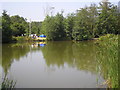
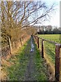
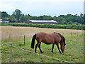
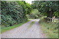
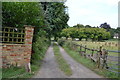
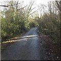
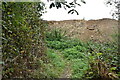
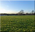


18 photos from this area
Area Information
Key information about the RH19 2PE including its size, population, and administrative classification.
- Area Type
- Postcode
- Area Size
- 14.5 hectares
- Population
- 2323
- Population Density
- 274 people/km²
House Prices in RH19 2PE
29
Properties
£712,300
Average Sold Price
£275,000
Lowest Price
£1,300,000
Highest Price
Showing 29 properties
| Address | Type | Beds | Baths | Last Sale Price | Last Sale Date | |
|---|---|---|---|---|---|---|
| Denhurst, Mill Lane, Felbridge, RH19 2PE | Bungalow | 2 | 1 | £605,000 | Apr 2024 | |
| Cotehele Cottage, Mill Lane, Felbridge, RH19 2PE | Detached | 4 | 3 | £895,000 | Jul 2023 | |
| Applegarth, Mill Lane, Felbridge, RH19 2PE | Bungalow | 4 | 2 | £1,300,000 | Jan 2023 | |
| Purbeck, Mill Lane, Felbridge, RH19 2PE | Detached | 4 | 2 | £615,000 | Oct 2022 | |
| Plyewell, Mill Lane, Felbridge, RH19 2PE | Retail | 5 | 4 | £1,250,000 | Aug 2022 | |
| Muskoka, Mill Lane, Felbridge, RH19 2PE | Detached | 4 | 1 | £920,000 | May 2022 | |
| Mikandras, Mill Lane, Felbridge, RH19 2PE | Detached | 5 | 3 | £940,000 | Feb 2020 | |
| Mallyan, Mill Lane, Felbridge, RH19 2PE | Detached | 5 | 2 | £725,000 | Nov 2019 | |
| Farmside, Mill Lane, Felbridge, RH19 2PE | Detached | 5 | 3 | £697,500 | Mar 2018 | |
| Mallards, Mill Lane, Felbridge, RH19 2PE | house | 4 | - | £500,000 | Jun 2012 |
Page 1 of 3
Energy Efficiency in RH19 2PE
Amenities
Schools
| Rank | School | Type | Entry gender | Ages |
|---|
Explore more schools in this area
Go to Schools tabDemographics
Household Size
Two person
most common
Accommodation Type
Houses
most common
Tenure
84
majority
Ethnic Group
White
most common
Religion
N/A
most common
Household Composition
N/A
most common
Age
47
median
Adults (30-64 years)
most common
Household Deprivation
N/A
with no deprivation
NS-SEC
46
in Lower managerial occupations
Explore more demographic insights in this area
Go to Demographics tabPlanning
Planning Constraints
- Flood RiskPremium
- Ramsar Wetland SitesPremium
- Area of Outstanding Natural BeautyPremium
- Protected Nature ReservePremium
- Protected WoodlandPremium