Area Overview for RH19 2FF
Photos of RH19 2FF
Area Information
Living in RH19 2FF offers a quiet residential existence within a small cluster where 1,733 residents call this postcode home. The area functions as a peaceful enclave distinguished by its focus on private dwellings, with houses forming the primary accommodation type available for purchase or rent. You will find an environment that prioritises stability and established rootstoabouts, rather than the transient nature of high-growth developments. As you navigate the streets, you see a community defined by long-term residency rather than rapid turnover. The layout supports a slower pace of life, ideal for those who value proximity to all necessary services without the noise of dense urban centres. Daily routines revolve around accessibility to local transport hubs and retail outlets, ensuring you remain connected to wider networks while enjoying a tranquil setting. This postcode represents a settled location where the physical surroundings reflect the needs of a mature, family-oriented population seeking security and convenience in one of East Grinstead's outer reaches.
- Area Type
- Postcode
- Area Size
- Not available
- Population
- 1733
- Population Density
- 4281 people/km²
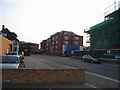
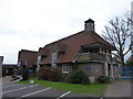
Homes in RH19 2FF are predominantly owner-occupied units, evidenced by the 71% home ownership rate recorded for this zone. This statistic indicates a market driven by settled buyers rather than landlords seeking short-term rental yields or students seeking temporary accommodation. The accommodation type is almost exclusively houses, meaning the streetscape is defined by detached, semi-detached, or terraced properties set on private plots rather than high-density flats or buildings. This housing stock suits families and individuals looking for space and permanence. Because the majority of occupants are homeowners, the area lacks the volatility of parts of London or Manchester where rental markets dominate. If you are purchasing a property here, you join a circle of residents who view their address as a legacy asset. The limited new build presence suggests you are buying into well-established neighborhoods where character and condition of the existing stock are the primary deciding factors.
House Prices in RH19 2FF
No properties found in this postcode.
Energy Efficiency in RH19 2FF
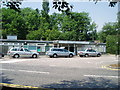
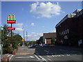
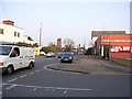
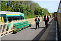
Residents of RH19 2FR enjoy convenient access to a range of amenities within practical reach, including five major retail outlets and five railway stations. You can shop at Budgens Lingfield, Aldi Dormans, or Morrisons Daily for your daily groceries and household requirements. For commuting, you have access to East Grinstead Railway Station, Dormans Railway Station, and Lingfield Railway Station, providing multiple flexible rail links. Furthermore, two bus stops named Kingscote and Horsted Keynes offer additional public transport options for those without a car. This combination of retail and rail ensures you can handle shopping trips or commute to London without significant travel times. The availability of these specific venues means you do not need to venture far to find what you need. Your day-to-day life is supported by a network of familiar shops and transport nodes that form an efficient loop around your home.
Amenities
Schools
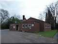
Families living in RH19 2FF have access to several educational institutions nearby, including Baldwins Hill Primary School and St Mary's CofE Primary School, both of which are situated in East Grinstead. Both primary schools hold a good Ofsted rating, confirming their quality provision and standards for student learning. You also find independent education options such as Highfield School, which serves families seeking private education. The presence of these schools means parents do not need to travel far to secure quality education for their children. The mix of state and independent provision caters to different educational philosophies and budget ranges. With two primary schools rated good, the area demonstrates a commitment to standardised excellence in early education. These institutions are key amenities that influence property desirability for families with school-aged children, ensuring you have immediate access to reputable learning environments.
| Rank | School | Type | Entry gender | Ages |
|---|
Explore more schools in this area
Go to Schools tabDemographics
The community profile of RH19 2FF reflects a mature population where 71% of households own their homes outright or have a significant stake. The median age of 47 confirms that most residents fall into the 30 to 64 years demographic, indicating a settled group with established careers and families. This high level of home ownership suggests a stable environment where change happens gradually rather than through constant moves. The prevailing demographic of adults in their prime working years supports a neighbourhood culture focused on practicality and local engagement rather than youthful transience. While specific income data is not available, the ownership figures point to a financially secure community capable of maintaining property values. Diversity metrics show White residents as the predominant ethnic group, characteristic of many historic South East locations. You are entering a sphere where neighbours likely have lived for decades, fostering strong local ties and a predictable social structure.
Household Size
Accommodation Type
Tenure
Ethnic Group
Religion
Household Composition
Age
Household Deprivation
NS-SEC
Explore more demographic insights in this area
Go to Demographics tabPlanning
Planning Constraints
- Flood RiskPremium
- Ramsar Wetland SitesPremium
- Area of Outstanding Natural BeautyPremium
- Protected Nature ReservePremium
- Protected WoodlandPremium