Area Overview for RH19 1ZE
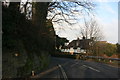
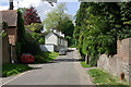
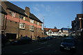
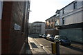
Photos of RH19 1ZE


Area Information
Living in RH19 1ZE places you within a specific postcode area that covers a small residential cluster. This location represents a distinct pocket of England with a total population of 1,171 people. The density and scale of this cluster mean daily life moves at a particular local pace, defined by immediate neighbours rather than broad urban crowds. You will find that this area functions as a self-contained residential unit where the character is shaped by its compact size and defined boundaries. Prospective homebuyers should note the intimate nature of this cluster, as it lacks the sprawling sprawl of larger towns. Instead, the experience of living here is characterised by proximity to specific points of interest within a tight geographical footprint. The area serves as a functional home for over one thousand residents who navigate their surroundings with a clear sense of place. Understanding this specific demographic container is essential before considering a move to RH19 1ZE.
- Area Type
- Postcode
- Area Size
- Not available
- Population
- 1171
- Population Density
- 7416 people/km²
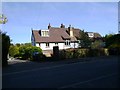
The property market in RH19 1ZE is distinctly shaped by the fact that flats form the predominant accommodation type in this cluster. While specific price data for individual homes in RH19 1ZE is not available to discuss within this general overview, the 42 per cent home ownership rate highlights a significant market segment. This ownership level indicates that a substantial number of residents have purchased their properties rather than renting, contributing to local stability. The prevalence of flats suggests that buyers should consider vertical living arrangements when searching for homes in this area. Such properties often appeal to professionals or downsizers who prefer the security of a specific age demographic. With a population of 1,171, the market size is inherently limited, meaning supply will be low whenever properties enter the market. Potential buyers looking at homes in RH19 1ZE must plan for a niche inventory that reflects the area's flat-heavy composition. The combination of high home ownership and specific property types defines a market driven by established residents rather than transient rental markets.
House Prices in RH19 1ZE
No properties found in this postcode.
Energy Efficiency in RH19 1ZE
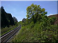
Residents of RH19 1ZE benefit from a practical range of amenities located within practical reach of the residential cluster. For shoppers, there are five retail outlets nearby, including Iceland East, Cook East, and Waitrose East. These supermarkets provide access to essential groceries and household essentials directly close to your postcode. For those without cars, five railway stations offer viable commuting options, including East Grinstead Railway Station, Dormans Railway Station, and Lingfield Railway Station. Two metro stations, Kingscote and Horsted Keynes, provide additional public transport links for this locality. This mix of rail and retail facilities ensures that daily errands and commutes do not require extensive travel beyond the immediate region. Living in RH19 1ZE means having your daily necessities and transport links readily accessible without navigating complex city centre traffic. The presence of Waitrose East alongside Iceland and Cook demonstrates a commitment to providing high-quality retail services for the local population. This amenity density supports an independent lifestyle where most routine needs can be met efficiently.
Amenities
Schools
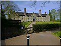
Families living in RH19 1ZE have access to The Manor School, which is located near the area. This institution operates as an independent school rather than a state-funded academy or community school. The presence of an independent option provides an alternative educational route for residents seeking private education for their children. While specific Ofsted ratings are not included in the available data, the existence of this facility confirms a choice between private schooling and local state options. The single listed school represents the primary formal education provision identified in the vicinity of RH19 1ZE. Potential parents must investigate current governance and academic performance independently, as the provided data only confirms the operational status and category of The Manor School. This limited selection of nearby schools means that residents often need to travel further for state education or rely on independent schooling if this facility meets their requirements. The dependence on one named institution like The Manor School characterises the educational infrastructure available to families choosing to live in this specific postcode.
| Rank | School | Type | Entry gender | Ages |
|---|
Explore more schools in this area
Go to Schools tabDemographics
The community in RH19 1ZE is defined by a clear adult demographic dominant in the 30 to 64 years age range. The median age across the cluster sits at 47 years, indicating a population leaning heavily towards middle and older adulthood. Forty-two per cent of households own their homes, a figure that suggests a significant portion of the local population has established long-term roots in this postcode. Accommodation types in the area are primarily flats, which shapes the living experience for those seeking urban comforts within a smaller setting. The predominant ethnic group is White, reflecting the broader demographic trends found in many residential clusters across this region of England. This age profile and property type mix creates a neighbourhood where residents often share similar life stages and housing needs. Families with school-aged children represent a minority compared to the dominant older adult population. The presence of 42 per cent owner-occupiers provides stability and a sense of permanence to the residential fabric of RH19 1ZE.
Household Size
Accommodation Type
Tenure
Ethnic Group
Religion
Household Composition
Age
Household Deprivation
NS-SEC
Explore more demographic insights in this area
Go to Demographics tabPlanning
Planning Constraints
- Flood RiskPremium
- Ramsar Wetland SitesPremium
- Area of Outstanding Natural BeautyPremium
- Protected Nature ReservePremium
- Protected WoodlandPremium