Area Overview for RH19 1NP
Photos of RH19 1NP

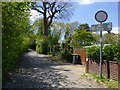


48 photos from this area
Area Information
Key information about the RH19 1NP including its size, population, and administrative classification.
- Area Type
- Postcode
- Area Size
- 1.0 hectares
- Population
- 1536
- Population Density
- 1116 people/km²
House Prices in RH19 1NP
19
Properties
£392,350
Average Sold Price
£125,000
Lowest Price
£845,000
Highest Price
Showing 19 properties
| Address | Type | Beds | Baths | Last Sale Price | Last Sale Date | |
|---|---|---|---|---|---|---|
| 34 Fairlawn Drive, East Grinstead, RH19 1NP | Detached | 4 | 3 | £845,000 | Nov 2023 | |
| 10 Fairlawn Drive, East Grinstead, RH19 1NP | Retail | 3 | 1 | £650,000 | Jul 2022 | |
| 38 Fairlawn Drive, East Grinstead, RH19 1NP | house | - | - | £575,000 | May 2022 | |
| 28 Fairlawn Drive, East Grinstead, RH19 1NP | Bungalow | 3 | 1 | £375,000 | Jun 2019 | |
| 4 Fairlawn Drive, East Grinstead, RH19 1NP | Detached | 3 | 3 | £410,000 | Oct 2013 | |
| 32 Fairlawn Drive, East Grinstead, RH19 1NP | house | - | - | £310,000 | Oct 2009 | |
| 30 Fairlawn Drive, East Grinstead, RH19 1NP | Detached | 4 | 3 | £360,000 | Jul 2006 | |
| 20 Fairlawn Drive, East Grinstead, RH19 1NP | Semi-detached | - | - | £135,000 | Jul 1999 | |
| 22 Fairlawn Drive, East Grinstead, RH19 1NP | Semi-detached | - | - | £125,000 | Nov 1998 | |
| 16 Fairlawn Drive, East Grinstead, RH19 1NP | Detached | - | - | £138,500 | Mar 1998 |
Page 1 of 2
Energy Efficiency in RH19 1NP
Amenities
Schools
| Rank | School | Type | Entry gender | Ages |
|---|
Explore more schools in this area
Go to Schools tabDemographics
Household Size
Family (3-5 people)
most common
Accommodation Type
Houses
most common
Tenure
91
majority
Ethnic Group
White
most common
Religion
N/A
most common
Household Composition
N/A
most common
Age
47
median
Adults (30-64 years)
most common
Household Deprivation
N/A
with no deprivation
NS-SEC
49
in Lower managerial occupations
Explore more demographic insights in this area
Go to Demographics tabPlanning
Planning Constraints
- Flood RiskPremium
- Ramsar Wetland SitesPremium
- Area of Outstanding Natural BeautyPremium
- Protected Nature ReservePremium
- Protected WoodlandPremium