Area Overview for RH19 1EW
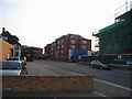
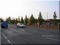
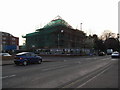
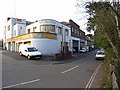
Photos of RH19 1EW


Area Information
Living in RH19 1EW within the East Grinstead area represents a specific residential cluster defined by stable demographics and strong connectivity. This postcode, which covers a small population of 2,195 residents, sits firmly within a mature part of the UK countryside. The local environment is characterised by a lack of restrictive planning constraints, presenting significant flexibility for development and renovation compared to protected zones. You will find this location free from flood risks, Ramsar wetland sites, Areas of Outstanding Natural Beauty, protected nature reserves, and designated protected woodland. These clearances reduce typical planning hurdles for owners. The area is not merely a postcode but a functioning community where daily life revolves around established retail links and rail access. Your daily commute or leisure trips are facilitated by immediate access to national road networks and five local railway stations, including East Grinstead, Dormans, and Lingfield. For a homebuyer seeking a footprint outside of high-constraint planning areas, RH19 1EW offers a straightforward profile. The community is dominated by adults aged 30 to 64, creating a neighbourhood focused on stability rather than rapid change. You gain access to five supermarkets and multiple transport hubs without the need to travel far for essentials. The absence of environmental red flags means you can focus on the property itself rather than external restrictions.
- Area Type
- Postcode
- Area Size
- Not available
- Population
- 2195
- Population Density
- 3842 people/km²
The property market in RH19 1EW is driven by long-term stability rather than rapid turnover. With 61% of the population owning their homes, the area functions as a classic owner-occupied neighbourhood. This high ownership percentage indicates that investors or short-term renters are not the primary market force here. Instead, your potential purchase is often holding hands with a resident who has lived there for years. The housing stock is dominated by flats, which is a defining characteristic of this small postcode cluster. This accommodation type influences the price point and lifestyle compared to detached houses in neighbouring areas. You are looking at a market where space is optimised and buildings form the physical structure of the streets. The lack of large detached family home dominance suggests a focus on convenience and proximity to local amenities like the nearby Morrisons or Sainsburys East. For a buyer, this environment means you are purchasing a slice of established community rather than a speculation play. The figure of 61% ownership acts as proof of market maturity. Homes in RH19 1EW hold their value because the residents are there to stay. You trade the appeal of large gardens for the security of a balanced catchment and a neighbourhood where the demographic skew towards ownership reduces the risk of mass displacement.
House Prices in RH19 1EW
No properties found in this postcode.
Energy Efficiency in RH19 1EW
Your lifestyle in RH19 1EW is defined by convenience and local access, supported by five prominent retail locations within practical reach. You can shop for groceries and daily essentials at Morrisons Daily or take advantage of the selection offered by Sainsburys East and Aldi Dormans. These retailers are positioned to serve the specific population needs of this residential cluster. Beyond retail, your transport options are substantial, with five railway stations nearby including East Grinstead, Dormans, and Lingfield providing easy exit points for daily commutes. The area also offers two other metro destinations, Kingscote and Horsted Keynes, which are easily accessible for weekend trips or leisure activities. This combination of five retail hubs and seven railway/metro links creates a lifestyle that minimises the need for long-distance travel. You do not need to venture far to access fresh food or catch a train. The local character remains residential, but the surrounding infrastructure supports a life that includes both community connection and regional exploration. When you live in RH19 1EW, you benefit from a network of amenities that is both extensive and locally anchored. The presence of these specific named venues ensures that your daily errands are efficient. You enjoy the speed of local shopping without the noise of a major high street, maintaining a balance between urban convenience and country living.
Amenities
Schools
| Rank | School | Type | Entry gender | Ages |
|---|
Explore more schools in this area
Go to Schools tabDemographics
The community in RH19 1EW reflects a mature, stable demographic profile where the average resident is 47 years old. The most common age range is adults between 30 and 64, indicating a population that has established careers and families. You will find that home stability is a key feature here, with 61% of households owning their properties outright or with a mortgage. This high ownership rate distinguishes the area from purely transient rental districts. Accommodation types in this specific cluster are primarily flats, suggesting a design influenced by space efficiency or local planning history. While the predominant ethnic group is White, the community is sufficiently established that diversity plays a background role to the dominant residential patterns. The population size of 2,195 creates a manageable scale where neighbours are likely to know one another, yet it remains large enough to support local services. The absence of significant deprivation data means quality of life is not hindered by poverty levels, allowing you to focus on the economic strength of the residents. The age profile suggests schools cater to young families and teenagers while local services address the needs of working adults and retirees. This demographic spread avoids the volatility of younger, transient populations. When considering homes in RH19 1EW, you are entering a market shaped by people who have stayed put for the long term.
Household Size
Accommodation Type
Tenure
Ethnic Group
Religion
Household Composition
Age
Household Deprivation
NS-SEC
Explore more demographic insights in this area
Go to Demographics tabPlanning
Planning Constraints
- Flood RiskPremium
- Ramsar Wetland SitesPremium
- Area of Outstanding Natural BeautyPremium
- Protected Nature ReservePremium
- Protected WoodlandPremium