Area Overview for RH19 1DW
Photos of RH19 1DW
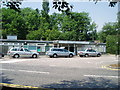
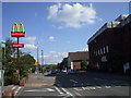
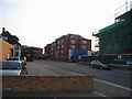
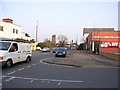
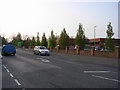
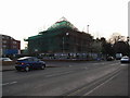
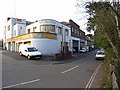
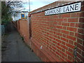
100 photos from this area
Area Information
Key information about the RH19 1DW including its size, population, and administrative classification.
- Area Type
- Postcode
- Area Size
- 1.5 hectares
- Population
- 1888
- Population Density
- 4154 people/km²
House Prices in RH19 1DW
16
Properties
£406,111
Average Sold Price
£110,000
Lowest Price
£675,000
Highest Price
Showing 16 properties
| Address | Type | Beds | Baths | Last Sale Price | Last Sale Date | |
|---|---|---|---|---|---|---|
| 17 Park Road, East Grinstead, RH19 1DW | Detached | 3 | 1 | £650,000 | Apr 2023 | |
| 3 Park Road, East Grinstead, RH19 1DW | Semi-detached | 4 | 1 | £675,000 | Nov 2021 | |
| 19 Park Road, East Grinstead, RH19 1DW | Detached | 4 | 1 | £485,000 | May 2013 | |
| Garland Bungalow, Park Road, East Grinstead, RH19 1DW | Bungalow | 4 | - | £470,000 | Apr 2010 | |
| The Bungalow, Park Road, East Grinstead, RH19 1DW | Bungalow | - | - | £305,000 | May 2009 | |
| Farmfield, Park Road, East Grinstead, RH19 1DW | Detached | - | - | £370,000 | Apr 2008 | |
| 7 Park Road, East Grinstead, RH19 1DW | Detached | 3 | - | £300,000 | Oct 2004 | |
| Acorns, Park Road, East Grinstead, RH19 1DW | Bungalow | 3 | 2 | £290,000 | Apr 2004 | |
| 15 Park Road, East Grinstead, RH19 1DW | Detached | - | - | £110,000 | Nov 1996 | |
| 13 Park Road, East Grinstead, RH19 1DW | Detached | 3 | 1 | - | - |
Page 1 of 2
Energy Efficiency in RH19 1DW
Amenities
Schools
| Rank | School | Type | Entry gender | Ages |
|---|
Explore more schools in this area
Go to Schools tabDemographics
Household Size
Two person
most common
Accommodation Type
Houses
most common
Tenure
79
majority
Ethnic Group
White
most common
Religion
N/A
most common
Household Composition
N/A
most common
Age
47
median
Adults (30-64 years)
most common
Household Deprivation
N/A
with no deprivation
NS-SEC
47
in Lower managerial occupations
Explore more demographic insights in this area
Go to Demographics tabPlanning
Planning Constraints
- Flood RiskPremium
- Ramsar Wetland SitesPremium
- Area of Outstanding Natural BeautyPremium
- Protected Nature ReservePremium
- Protected WoodlandPremium