Area Overview for RH19 1DH
Photos of RH19 1DH
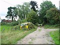
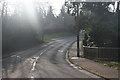
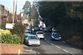
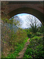
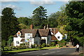
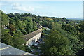
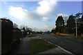
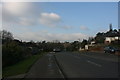
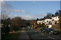
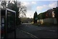
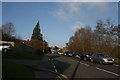
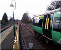
98 photos from this area
Area Information
Key information about the RH19 1DH including its size, population, and administrative classification.
- Area Type
- Postcode
- Area Size
- 1.5 hectares
- Population
- 1681
- Population Density
- 4675 people/km²
House Prices in RH19 1DH
25
Properties
£255,875
Average Sold Price
£124,500
Lowest Price
£365,000
Highest Price
Showing 25 properties
| Address | Type | Beds | Baths | Last Sale Price | Last Sale Date | |
|---|---|---|---|---|---|---|
| 48 Copyhold Road, East Grinstead, RH19 1DH | Semi-detached | 2 | 1 | £318,000 | Apr 2024 | |
| 22 Copyhold Road, East Grinstead, RH19 1DH | Retail | 3 | 2 | £350,000 | Dec 2022 | |
| 34 Copyhold Road, East Grinstead, RH19 1DH | Terraced | 2 | 1 | £365,000 | Jun 2022 | |
| 6 Copyhold Road, East Grinstead, RH19 1DH | house | 3 | - | £325,000 | Apr 2016 | |
| 36 Copyhold Road, East Grinstead, RH19 1DH | house | 2 | - | £197,500 | Mar 2012 | |
| 12 Copyhold Road, East Grinstead, RH19 1DH | Terraced | - | - | £233,000 | Dec 2006 | |
| 32 Copyhold Road, East Grinstead, RH19 1DH | Terraced | 2 | 1 | £134,000 | Jan 2003 | |
| 10 Copyhold Road, East Grinstead, RH19 1DH | house | - | - | £124,500 | Jan 2002 | |
| 18 Copyhold Road, East Grinstead, RH19 1DH | house | - | - | - | - | |
| 24 Copyhold Road, East Grinstead, RH19 1DH | house | - | - | - | - |
Page 1 of 3
Energy Efficiency in RH19 1DH
Amenities
Schools
| Rank | School | Type | Entry gender | Ages |
|---|
Explore more schools in this area
Go to Schools tabDemographics
Household Size
One person
most common
Accommodation Type
Flats
most common
Tenure
47
majority
Ethnic Group
White
most common
Religion
N/A
most common
Household Composition
N/A
most common
Age
47
median
Adults (30-64 years)
most common
Household Deprivation
N/A
with no deprivation
NS-SEC
32
in Lower managerial occupations
Explore more demographic insights in this area
Go to Demographics tabPlanning
Planning Constraints
- Flood RiskPremium
- Ramsar Wetland SitesPremium
- Area of Outstanding Natural BeautyPremium
- Protected Nature ReservePremium
- Protected WoodlandPremium