Area Overview for RH19 1BD
Photos of RH19 1BD
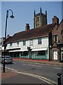
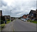
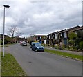
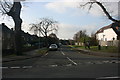
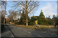
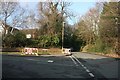
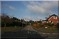
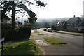
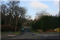
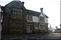
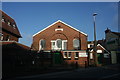
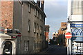
100 photos from this area
Area Information
Key information about the RH19 1BD including its size, population, and administrative classification.
- Area Type
- Postcode
- Area Size
- 5176 m²
- Population
- 1681
- Population Density
- 4675 people/km²
House Prices in RH19 1BD
37
Properties
£247,405
Average Sold Price
£58,000
Lowest Price
£355,000
Highest Price
Showing 37 properties
| Address | Type | Beds | Baths | Last Sale Price | Last Sale Date | |
|---|---|---|---|---|---|---|
| 110 Queens Road, East Grinstead, RH19 1BD | Terraced | 2 | 1 | £345,000 | Dec 2025 | |
| 76 Queens Road, East Grinstead, RH19 1BD | Semi-detached | 2 | 1 | £340,000 | Feb 2025 | |
| 108 Queens Road, East Grinstead, RH19 1BD | Terraced | 3 | 1 | £355,000 | Dec 2023 | |
| 94 Queens Road, East Grinstead, RH19 1BD | Terraced | 2 | 1 | £292,500 | May 2023 | |
| 88 Queens Road, East Grinstead, RH19 1BD | house | - | - | £345,000 | Nov 2022 | |
| Sorrell Cottage, 126 Queens Road, East Grinstead, RH19 1BD | Semi-detached | 2 | 1 | £280,000 | Sep 2022 | |
| Post Box Cottage, 128 Queens Road, East Grinstead, RH19 1BD | Retail | 2 | 1 | £285,000 | Jul 2022 | |
| 116 Queens Road, East Grinstead, RH19 1BD | Terraced | 2 | 2 | £285,000 | Oct 2020 | |
| 90 Queens Road, East Grinstead, RH19 1BD | Terraced | 2 | - | £312,000 | May 2019 | |
| 86 Queens Road, East Grinstead, RH19 1BD | Semi-detached | 2 | 1 | £330,000 | Feb 2018 |
Page 1 of 4
Energy Efficiency in RH19 1BD
Amenities
Schools
| Rank | School | Type | Entry gender | Ages |
|---|
Explore more schools in this area
Go to Schools tabDemographics
Household Size
One person
most common
Accommodation Type
Flats
most common
Tenure
47
majority
Ethnic Group
White
most common
Religion
N/A
most common
Household Composition
N/A
most common
Age
47
median
Adults (30-64 years)
most common
Household Deprivation
N/A
with no deprivation
NS-SEC
32
in Lower managerial occupations
Explore more demographic insights in this area
Go to Demographics tabPlanning
Planning Constraints
- Flood RiskPremium
- Ramsar Wetland SitesPremium
- Area of Outstanding Natural BeautyPremium
- Protected Nature ReservePremium
- Protected WoodlandPremium