Area Overview for RH18 5DS
Photos of RH18 5DS
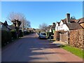
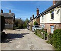
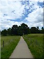
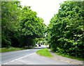
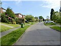
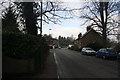
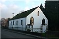
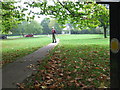
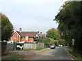
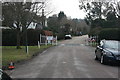
80 photos from this area
Area Information
Key information about the RH18 5DS including its size, population, and administrative classification.
- Area Type
- Postcode
- Area Size
- 3.8 hectares
- Population
- 2298
- Population Density
- 1217 people/km²
House Prices in RH18 5DS
48
Properties
£342,097
Average Sold Price
£79,500
Lowest Price
£1,250,000
Highest Price
Showing 48 properties
| Address | Type | Beds | Baths | Last Sale Price | Last Sale Date | |
|---|---|---|---|---|---|---|
| 66 Upper Close, Forest Row, RH18 5DS | house | 2 | 2 | £480,000 | May 2024 | |
| 64 Upper Close, Forest Row, RH18 5DS | Detached | 4 | 3 | £510,000 | Apr 2024 | |
| The Coach House, Upper Close, Forest Row, RH18 5DS | Detached | 5 | 3 | £1,250,000 | Mar 2023 | |
| 70 Upper Close, Forest Row, RH18 5DS | Detached | 3 | 2 | £490,000 | Feb 2023 | |
| 51 Upper Close, Forest Row, RH18 5DS | house | - | - | £630,000 | Aug 2022 | |
| 63 Upper Close, Forest Row, RH18 5DS | house | - | - | £725,000 | Jun 2021 | |
| 49 Upper Close, Forest Row, RH18 5DS | Semi-detached | 3 | 1 | £510,000 | May 2021 | |
| 35 Upper Close, Forest Row, RH18 5DS | house | - | - | £300,000 | Sep 2019 | |
| 7 Upper Close, Forest Row, RH18 5DS | Semi-detached | 3 | 1 | £420,000 | Mar 2019 | |
| 62 Upper Close, Forest Row, RH18 5DS | Semi-detached | - | - | £160,000 | Oct 2018 |
Page 1 of 5
Energy Efficiency in RH18 5DS
Amenities
Schools
| Rank | School | Type | Entry gender | Ages |
|---|
Explore more schools in this area
Go to Schools tabDemographics
Household Size
Family (3-5 people)
most common
Accommodation Type
Houses
most common
Tenure
65
majority
Ethnic Group
White
most common
Religion
N/A
most common
Household Composition
N/A
most common
Age
47
median
Adults (30-64 years)
most common
Household Deprivation
N/A
with no deprivation
NS-SEC
40
in Lower managerial occupations
Explore more demographic insights in this area
Go to Demographics tabPlanning
Planning Constraints
- Flood RiskPremium
- Ramsar Wetland SitesPremium
- Area of Outstanding Natural BeautyPremium
- Protected Nature ReservePremium
- Protected WoodlandPremium