Area Overview for RH18 5DA
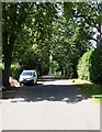
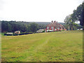
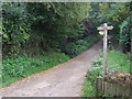
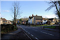
Photos of RH18 5DA


Area Information
Living in RH18 5DA means residing in a compact residential cluster defined by a specific postcode covering exactly 6,630 square metres. This small footprint supports a population of 2,298 people, resulting in a density of 1,217 individuals per square kilometre. The area functions as a focused neighbourhood where daily life revolves around immediate local needs rather than sprawling suburban distance. You can expect a setting that prioritises proximity and established community patterns over rapid expansion. The character of RH18 5DA is shaped by its compact nature and the specific demographic profile of its residents. With a median age of 47, the community reflects a settled population rather than a transient workforce transiently passing through. This demographic reality influences the pace of neighbourhood life and the types of services that have historically supported the area. Prospective buyers entering this market encounter a slice of life that balances suburban convenience with the intimacy of a smaller settlement. Every house in RH18 5DA sits within a defined environment where boundaries are clear and local interactions likely follow consistent routines. For those considering homes in this postcode, understanding the scale is essential. The limited area size creates a distinct sense of place compared to larger districts. Residents navigate a landscape where the distance to key amenities often feels manageable due to the concentrated character of the housing stock. This environment suits individuals seeking a defined residential zone with clear limits and a strong connection to the immediate surroundings.
- Area Type
- Postcode
- Area Size
- 6630 m²
- Population
- 2298
- Population Density
- 1217 people/km²
The housing market in RH18 5DA is heavily characterised by owner-occupancy, with 65 per cent of homes held by their owners. This statistic confirms that the area functions primarily as a residential base for settled families rather than a hub for student tenants or short-term renters. You will find that the property stock is designed for long-term living, with architectural styles and layouts reflecting the needs of households that intend to stay for many years. Houses constitute the main accommodation type available in RH18 5DA. This predominance means that buyers seeking flats or apartments will not find them within this specific postcode boundary. The available homes are traditional structures, likely offering gardens and more space than urban alternatives. For purchasers looking at homes in this location, the physical diversity is limited compared to larger towns but offers consistency in terms of interior layout and exterior setting. The high home ownership rate indicates that price sensitivity often drives the market differently here than in investment-heavy zones. Sellers in RH18 5DA are frequently motivated by life changes such as retirement or downsizing, given the age profile of the residents. This dynamic can create specific opportunities for buyers looking to acquire properties that have been well-maintained by long-term owners. However, the lack of rental stock means you must compete directly with other buyers rather than competing with landlords who might accept lower yields. When assessing value in this area, you are evaluating a stable asset within a low-density setting. The focus remains on home ownership rather than the churn typical of student cities. Buyers should approach the market with the understanding that transactions involve established residents looking to secure their asset value or relocate for personal reasons. The composition of the housing stock ensures that properties generally offer the space and grounds associated with house living.
House Prices in RH18 5DA
Showing 8 properties
| Address | Type | Beds | Baths | Last Sale Price | Last Sale Date | |
|---|---|---|---|---|---|---|
| Stonehouse Cottage, Hartfield Road, Forest Row, RH18 5DA | Detached | 2 | 1 | £775,000 | May 2025 | |
| 1, Stonehouse Flats, Hartfield Road, Forest Row, RH18 5DA | Flat | 2 | 1 | £295,000 | Aug 2024 | |
| 3, Stonehouse Flats, Hartfield Road, Forest Row, RH18 5DA | Flat | - | - | £205,000 | Jul 2014 | |
| 4, Stonehouse Flats, Hartfield Road, Forest Row, RH18 5DA | Flat | 2 | 1 | £212,500 | Jul 2014 | |
| Coach House, Hartfield Road, Forest Row, RH18 5DA | house | - | - | £550,000 | May 2013 | |
| Stonehouse, Hartfield Road, Forest Row, RH18 5DA | Semi-detached | - | - | - | - | |
| Stonehouse South, Hartfield Road, Forest Row, RH18 5DA | Semi-detached | - | - | - | - | |
| 2, Stonehouse Flats, Hartfield Road, Forest Row, RH18 5DA | Flat | - | - | - | - |
Energy Efficiency in RH18 5DA
Residents of RH18 5DA benefit from a curated set of amenities within practical reach. Retail options are accessible through five nearby shops, including Co-op Forest, Tesco Forest, and Cook East. These venues provide necessary shopping demands such as groceries, household goods, and daily essentials. With Co-op Forest and Tesco Forest available, you can complete most of your weekly shopping without extensive travel. Transport connectivity links the area to broader networks via five contact points with rail services. East Grinstead Railway Station, Dormans Railway Station, and Cowden Railway Station serve as key hubs for commuting to Brighton, London, and other parts of the South East. This rail access ensures that living in RH18 5DA does not isolate you from major urban centres. You can combine the quiet of a residential cluster with the connectivity of a rail-linked town. Metro access is available through two stations at Kingscote and Horsted Keynes. These stops likely offer bus or tram links that further expand your travel options beyond the rail network. The combination of rail and metro links creates a flexible transport web that supports both daily commutes and leisure trips. Dining, events, and cultural activities are thus reachable without needing a car for every journey. Amenity clusters around Forest Row and East Grinstead enhance the lifestyle of residents in RH18 5DA. You will find convenient access to supermarkets and transport nodes that simplify daily routines. This blend of local convenience and regional connectivity defines the practical lifestyle available in this postcode.
Amenities
Schools
Families considering homes in RH18 5DA have access to a selection of educational institutions nearby. Forest Row Church of England Primary School and Nursery serves the primary education sector within close reach of the postcode. This school holds a Good rating from Ofsted, providing assurance of a standard educational environment for younger children. The presence of this primary school indicates that early years education is a developed part of the local community infrastructure. Parents residing in RH18 5DA can expect their children to attend Forest Row Church of England Primary School and Nursery without travelling across significant distances to larger towns. This accessibility supports families who prioritise shorter commutes for school runs and a stable educational routine for their children. While the specific list provided does not include secondary schools, the existence of a well-rated primary institution suggests a readiness to support local children's educational needs. The school's Church of England designation may also be relevant for families seeking an education aligned with specific faith traditions. You can rely on the data showing that Forest Row Church of England Primary School and Nursery is operational and recognised for its quality. Families moving to the area should note that school placement can be competitive even in smaller postcodes. The Good rating of Forest Row Church of England Primary School and Nursery confirms a baseline of quality, but parents should still check admission criteria and catchment areas directly with the school office. The mix of a single identified primary provider highlights the need for thorough research regarding secondary school arrangements for older children, though local options often exist a short drive away.
| Rank | School | Type | Entry gender | Ages |
|---|
Explore more schools in this area
Go to Schools tabDemographics
The community within RH18 5DA is dominated by adults aged between 30 and 64 years. This age range constitutes the most common demographic group, aligning with a median age of 47 across the population. Such a profile suggests a neighbourhood established by middle-aged families and older professionals rather than young students or retirees. The stability indicated by this age distribution often correlates with longer-term residency and a vested interest in local improvements. Home ownership stands at 65 per cent within the area. This figure places a significant majority of households in the position of owners rather than tenants. When you look at RH18 5DA, you will find that three out of every four residents have a direct stake in the upkeep and long-term value of their property. This high rate of ownership typically fosters a more consistent approach to maintenance and neighbourhood standards compared to areas with higher rental proportions. Houses form the predominant accommodation type in the region. This preference for detached or semi-detached housing over flats or high-rise blocks shapes the streetscape and noise levels throughout the day. The physical layout supports a quieter living environment suited to those who prioritise space and privacy. Ethnically, the predominant group is White, reflecting the broader historical settlement patterns common to many parts of Sussex. These demographics paint a picture of a stable, family-oriented community where neighbours often know one another across multiple generations of local families.
Household Size
Accommodation Type
Tenure
Ethnic Group
Religion
Household Composition
Age
Household Deprivation
NS-SEC
Explore more demographic insights in this area
Go to Demographics tabPlanning
Planning Constraints
- Flood RiskPremium
- Ramsar Wetland SitesPremium
- Area of Outstanding Natural BeautyPremium
- Protected Nature ReservePremium
- Protected WoodlandPremium