Area Overview for RH17 7NJ
Photos of RH17 7NJ
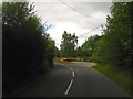
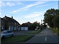
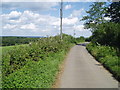
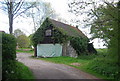
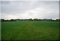
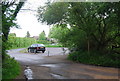
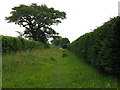
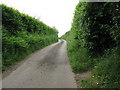
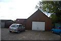

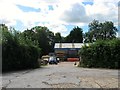
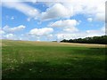
77 photos from this area
Area Information
Key information about the RH17 7NJ including its size, population, and administrative classification.
- Area Type
- Postcode
- Area Size
- 1.0 km²
- Population
- 1583
- Population Density
- 68 people/km²
House Prices in RH17 7NJ
31
Properties
£1,363,600
Average Sold Price
£125,000
Lowest Price
£4,500,000
Highest Price
Showing 31 properties
| Address | Type | Beds | Baths | Last Sale Price | Last Sale Date | |
|---|---|---|---|---|---|---|
| Hollybank, Nash Lane, Scaynes Hill, RH17 7NJ | Detached | 4 | 2 | £700,000 | Dec 2023 | |
| Butterbox Cottage, Nash Lane, Scaynes Hill, RH17 7NJ | Semi-detached | 4 | 2 | £910,000 | Apr 2023 | |
| Orchard Farm, Nash Lane, Scaynes Hill, RH17 7NJ | Detached | 6 | 4 | £2,400,000 | Mar 2023 | |
| Nash Farm, Nash Lane, Scaynes Hill, RH17 7NJ | Detached | 4 | 2 | £4,500,000 | Sep 2022 | |
| Pegden House, Nash Lane, Scaynes Hill, RH17 7NJ | Retail | 4 | 4 | £2,200,000 | May 2022 | |
| Downsview, Nash Lane, Scaynes Hill, RH17 7NJ | Chalet | 6 | 3 | £685,000 | Jul 2019 | |
| The Wilderness, Nash Lane, Scaynes Hill, RH17 7NJ | house | - | - | £867,000 | Feb 2019 | |
| The Wallhouse, Nash Lane, Scaynes Hill, RH17 7NJ | Detached | - | - | £750,000 | Oct 2004 | |
| Virginia Cottage, Nash Lane, Scaynes Hill, RH17 7NJ | Detached | - | - | £499,000 | Aug 2004 | |
| Pear Tree Cottage, Nash Lane, Scaynes Hill, RH17 7NJ | Detached | 4 | 2 | £125,000 | Feb 1996 |
Page 1 of 4
Energy Efficiency in RH17 7NJ
Amenities
Schools
| Rank | School | Type | Entry gender | Ages |
|---|
Explore more schools in this area
Go to Schools tabDemographics
Household Size
Two person
most common
Accommodation Type
Houses
most common
Tenure
76
majority
Ethnic Group
White
most common
Religion
N/A
most common
Household Composition
N/A
most common
Age
47
median
Adults (30-64 years)
most common
Household Deprivation
N/A
with no deprivation
NS-SEC
45
in Lower managerial occupations
Explore more demographic insights in this area
Go to Demographics tabPlanning
Planning Constraints
- Flood RiskPremium
- Ramsar Wetland SitesPremium
- Area of Outstanding Natural BeautyPremium
- Protected Nature ReservePremium
- Protected WoodlandPremium