Area Overview for RH17 7JZ
Photos of RH17 7JZ
Area Information
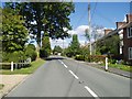
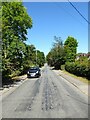
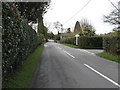
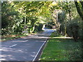
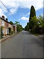
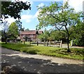
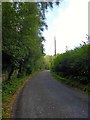
Living in RH17 7JZ offers a distinctly quiet rural existence within the Horsham District of England. This specific postcode covers a compact residential cluster spanning just 10.3 hectares, containing a population of 2093 people. The low population density of 85 people per square kilometre creates a spacious environment where neighbours rarely overlap. You will find yourself in a setting that prioritises privacy and access to open space over urban convenience. This area functions as a self-contained hamlet, offering a respite from the pace of larger towns without requiring significant travel for essential needs. The village character is defined by its small scale and cohesive community structure. Residents enjoy a direct connection to the surrounding countryside, which forms the backdrop to daily life. You are positioned to access nearby market towns for broader services while maintaining a lifestyle centred on local familiarity. The geographical isolation fosters a tight-knit atmosphere where community events and local interactions hold greater significance. This makes RH17 7JZ suitable for those seeking stability away from the pressure of city living. The small size of the postcode area ensures that every detail of the local environment remains visible and manageable.
- Area Type
- Postcode
- Area Size
- 10.3 hectares
- Population
- 2093
- Population Density
- 85 people/km²
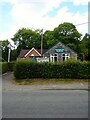
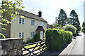
RH17 7JZ operates almost entirely as an owner-occupied market rather than a rental hub. The home ownership percentage reaches 92%, which is exceptionally high even for established residential areas elsewhere in England. This statistic dictates the property market dynamics, as you will find very few rental properties available within this postcode. Houses form the primary accommodation type, meaning buyers can expect to look at single-story, detached, or semi-detached homes rather than flats or apartments. The low vacancy implied by such high ownership rates suggests that selling a property in this area may take longer than in more transient districts. Buyers should be prepared for a market where distances between homes are greater and individual properties hold significant land value due to the low population density. The housing stock reflects the needs of families and empty nesters who have accumulated equity over decades. Consequently, renovation projects or extensions may be common features in the housing stock given the extensive land associated with each home.
House Prices in RH17 7JZ
Showing 3 properties
| Address | Type | Beds | Baths | Last Sale Price | Last Sale Date | |
|---|---|---|---|---|---|---|
| Chelworth House, Sandy Lane, Chelwood Gate, RH17 7JZ | Detached | - | - | £675,000 | Jul 1995 | |
| Puzzle Cottage, Sandy Lane, Chelwood Gate, RH17 7JZ | Detached | 3 | 2 | - | - | |
| Tennis 79M From Chelworth House, Sandy Lane 36M From Unnamed Road, Sandy Lane, Chelwood Gate, RH17 7JZ | Leisure | - | - | - | - |
Energy Efficiency in RH17 7JZ
Amenities
Schools
Families settling in RH17 7JZ have access to a mix of state and independent education options nearby. Danehill Church of Education Primary School sits close to the area and holds an Ofsted rating of good. This school provides a state-funded option for primary education for children living in the village. For private education, two independent schools serve the local community, including Cumnor House School and Holly House School. These institutions offer alternativecurriculum choices for parents who prefer an exclusive environment outside the state system. The presence of both a state primary and multiple independent schools indicates a choice available to families regardless of budget constraints. However, practical access to secondary schools requires travelling outside this small rural cluster, as none are listed within the immediate vicinity. Parents considering this postcode must plan their commutes accordingly, dealing with travel time to larger towns for older children. The combination of a good-rated local primary and nearby independent options makes the area viable for younger children, despite the absence of secondary institutions on the doorstep.
| Rank | School | Type | Entry gender | Ages |
|---|
Explore more schools in this area
Go to Schools tabDemographics
The community in RH17 7JZ presents a mature demographic profile with a median age of 47 years. Adults between 30 and 64 years constitute the most common age range, indicating a neighbourhood populated by established households rather than young families or retirees. Home ownership stands at an overwhelming 92%, meaning almost every resident lives in a property they own outright or have a significant mortgage on. This high rate suggests financial stability among the population and a preference for long-term settlement over rental arrangements. Houses are the predominant accommodation type in the area, reflecting the rural nature of the settlement and the availability of detached or semi-detached stock. The predominant ethnic group is White, which aligns with the typical demographic makeup of many historic villages in the wider South East. There is no significant data suggesting a diverse mix of ethnicities within this specific small cluster. The population composition points to a stable, settled community where residents have likely lived in RH17 7JZ for many years. This demographic consistency supports a predictable social environment for anyone considering moving here.
Household Size
Accommodation Type
Tenure
Ethnic Group
Religion
Household Composition
Age
Household Deprivation
NS-SEC
Explore more demographic insights in this area
Go to Demographics tabPlanning
Planning Constraints
- Flood RiskPremium
- Ramsar Wetland SitesPremium
- Area of Outstanding Natural BeautyPremium
- Protected Nature ReservePremium
- Protected WoodlandPremium