Area Overview for RH17 6UN
Photos of RH17 6UN
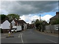
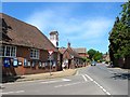
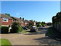
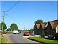
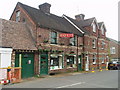
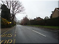
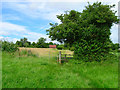
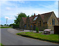
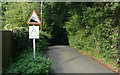
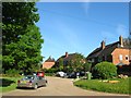
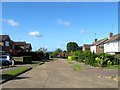
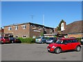
100 photos from this area
Area Information
Key information about the RH17 6UN including its size, population, and administrative classification.
- Area Type
- Postcode
- Area Size
- 5.5 hectares
- Population
- 1878
- Population Density
- 117 people/km²
House Prices in RH17 6UN
7
Properties
£673,625
Average Sold Price
£450,000
Lowest Price
£1,225,000
Highest Price
Showing 7 properties
| Address | Type | Beds | Baths | Last Sale Price | Last Sale Date | |
|---|---|---|---|---|---|---|
| Tinkers Croft, Street Lane, Ardingly, RH17 6UN | Detached | - | - | £1,225,000 | Dec 2012 | |
| Nottingham Cottage, Street Lane, Ardingly, RH17 6UN | Semi-detached | 3 | 2 | £547,500 | Oct 2012 | |
| Jordans Cottage, Street Lane, Ardingly, RH17 6UN | Detached | - | - | £472,000 | Apr 2005 | |
| Pine Trees, Street Lane, Ardingly, RH17 6UN | Detached | - | - | £450,000 | Oct 2003 | |
| 1, Church Cottages, Street Lane, Ardingly, RH17 6UN | Semi-detached | 3 | 2 | - | - | |
| 2, Church Cottages, Street Lane, Ardingly, RH17 6UN | Retail | 3 | 2 | - | - | |
| St Peters Church Centre, Street Lane, Ardingly, RH17 6UN | commercial | - | - | - | - |
Energy Efficiency in RH17 6UN
Amenities
Schools
| Rank | School | Type | Entry gender | Ages |
|---|
Explore more schools in this area
Go to Schools tabDemographics
Household Size
Two person
most common
Accommodation Type
Houses
most common
Tenure
71
majority
Ethnic Group
White
most common
Religion
N/A
most common
Household Composition
N/A
most common
Age
47
median
Adults (30-64 years)
most common
Household Deprivation
N/A
with no deprivation
NS-SEC
42
in Lower managerial occupations
Explore more demographic insights in this area
Go to Demographics tabPlanning
Planning Constraints
- Flood RiskPremium
- Ramsar Wetland SitesPremium
- Area of Outstanding Natural BeautyPremium
- Protected Nature ReservePremium
- Protected WoodlandPremium