Area Overview for RH17 5QT
Photos of RH17 5QT

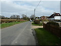
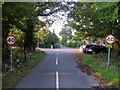
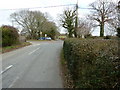
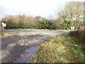

52 photos from this area
Area Information
Key information about the RH17 5QT including its size, population, and administrative classification.
- Area Type
- Postcode
- Area Size
- 6.8 hectares
- Population
- 1159
- Population Density
- 73 people/km²
House Prices in RH17 5QT
11
Properties
£620,000
Average Sold Price
£620,000
Lowest Price
£620,000
Highest Price
Showing 11 properties
| Address | Type | Beds | Baths | Last Sale Price | Last Sale Date | |
|---|---|---|---|---|---|---|
| Upper Garstons, Cowfold Road, Bolney, RH17 5QT | Detached | 3 | 1 | £620,000 | Feb 2020 | |
| Flat, Bolney Place, Cowfold Road, Bolney, RH17 5QT | Flat | - | - | - | - | |
| Blackman Terry Accountants, Bolney Place, Cowfold Road, Bolney, RH17 5QT | Office | - | - | - | - | |
| Mas Technicae Group Ltd, Mas Technicae, Bolney Place, Cowfold Road, Bolney, RH17 5QT | Office | - | - | - | - | |
| Pure Crete, Bolney Place, Cowfold Road, Bolney, RH17 5QT | Office | - | - | - | - | |
| Ilios Travel Ltd, Bolney Place, Cowfold Road, Bolney, RH17 5QT | Office | - | - | - | - | |
| Bolney Place, Cowfold Road, Bolney, RH17 5QT | Office | - | - | - | - | |
| Three Monkey Design Ltd, Bolney Place, Cowfold Road, Bolney, RH17 5QT | Office | - | - | - | - | |
| Independant Aviation Group Ltd, I A G, Bolney Place, Cowfold Road, Bolney, RH17 5QT | Office | - | - | - | - | |
| Blue Coral, Bolney Place, Cowfold Road, Bolney, RH17 5QT | Office | - | - | - | - |
Page 1 of 2
Energy Efficiency in RH17 5QT
Amenities
Schools
| Rank | School | Type | Entry gender | Ages |
|---|
Explore more schools in this area
Go to Schools tabDemographics
Household Size
Family (3-5 people)
most common
Accommodation Type
Houses
most common
Tenure
76
majority
Ethnic Group
White
most common
Religion
N/A
most common
Household Composition
N/A
most common
Age
47
median
Adults (30-64 years)
most common
Household Deprivation
N/A
with no deprivation
NS-SEC
47
in Lower managerial occupations
Explore more demographic insights in this area
Go to Demographics tabPlanning
Planning Constraints
- Flood RiskPremium
- Ramsar Wetland SitesPremium
- Area of Outstanding Natural BeautyPremium
- Protected Nature ReservePremium
- Protected WoodlandPremium